GOES-18: Geostationary Weather Sentinel
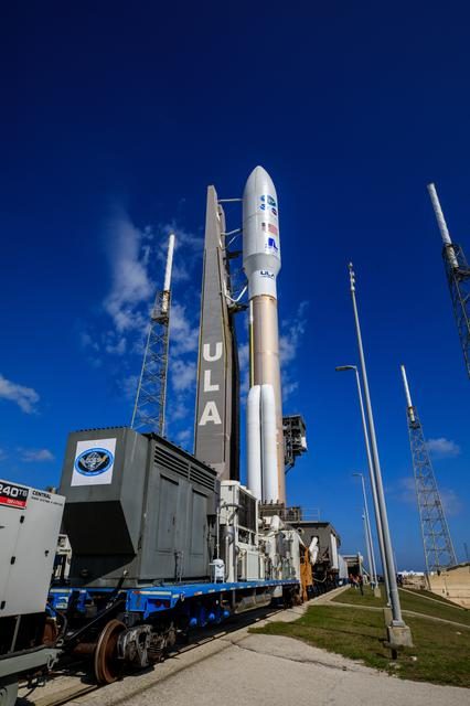
GOES-18, also known as GOES-T prior to its successful launch, is a geostationary weather satellite operated by the National Oceanic and Atmospheric Administration (NOAA). It is part of the Geostationary Operational Environmental Satellites (GOES) programme, which provides real-time weather data and
What is GOES-18?
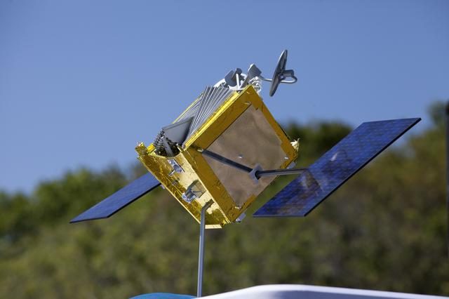
GOES-18, also known as GOES-T prior to its successful launch, is a geostationary weather satellite operated by the National Oceanic and Atmospheric Administration (NOAA). It is part of the Geostationary Operational Environmental Satellites (GOES) programme, which provides real-time weather data and monitoring for the United States. The satellite is equipped with advanced instruments to monitor atmospheric conditions, solar activity, and space weather phenomena.
Mission and Purpose
The primary mission of GOES-18 is to provide continuous weather monitoring and forecasting capabilities. It plays a critical role in tracking severe weather events such as hurricanes, thunderstorms, and wildfires. The satellite's instruments, including the Advanced Baseline Imager (ABI), allow for high-resolution imaging of Earth's atmosphere, providing valuable data for meteorologists and researchers. GOES-18 also contributes to space weather monitoring by observing solar flares and geomagnetic storms.
Orbital Characteristics
GOES-18 is positioned in a geostationary orbit, approximately 35,786 kilometres above the equator, allowing it to maintain a constant view of the same region of Earth. This orbit enables the satellite to provide uninterrupted data coverage for the Western Hemisphere. With a NORAD ID of 49260, GOES-18 orbits Earth with a period of 24 hours, matching the planet's rotation. This stationary positioning is crucial for continuous weather observation and forecasting.
Significance and Legacy
GOES-18 represents the latest advancement in NOAA's GOES programme, which has been operational since the 1970s. The satellite's enhanced imaging capabilities and improved data transmission rates significantly enhance weather forecasting accuracy and response times to natural disasters. Its contributions to climate research and environmental monitoring further underscore its importance. As part of a long-standing legacy, GOES-18 continues to build on the successes of its predecessors, ensuring reliable weather data for years to come.
Current Status
As of 14 September 2026, GOES-18 remains fully operational and continues to deliver critical weather data to NOAA and other meteorological agencies. The satellite's real-time data is vital for weather prediction models and emergency response planning. According to Orbital Radar's live catalogue, GOES-18 is one of 1,478 active satellites in geostationary orbit. Its status and operational data can be further explored through the Orbital Radar Satellite Library.
📎 Cite this article
Orbital Radar Newsroom. (2026). GOES-18: Geostationary Weather Sentinel. Orbital Radar. https://orbitalradar.com/blog/goes-18-geostationary-weather-sentinel"GOES-18: Geostationary Weather Sentinel." Orbital Radar, 14 September 2026, https://orbitalradar.com/blog/goes-18-geostationary-weather-sentinel.@misc{orbitalradar_goes_18_geostationary_weather_sentinel,
title = {GOES-18: Geostationary Weather Sentinel},
author = {{Orbital Radar}},
year = {2026},
howpublished = {\url{https://orbitalradar.com/blog/goes-18-geostationary-weather-sentinel}}
}