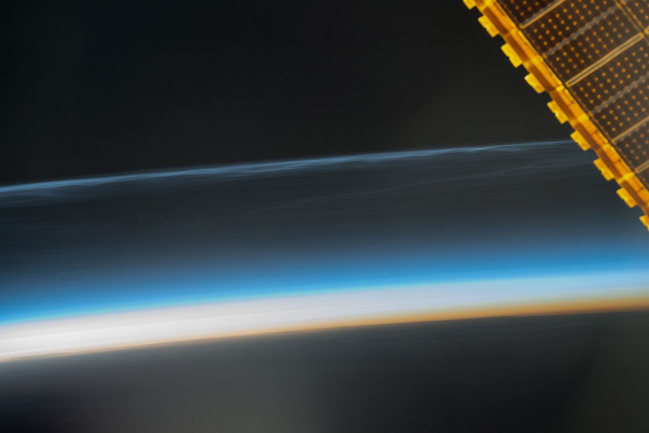
How Do Radar Satellites Work? SAR Explained
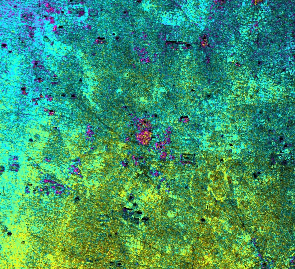
Radar satellites illuminate Earth with microwaves rather than waiting for sunlight. Learn how their echoes become images, what SAR reveals and where its limits lie.
| Active satellites | 15,925 |
| Starlink active | 9,980 |
| Catalogued objects | 31,941 |
| Active close approaches | 16 |
| People in space | 10 |
Radar satellites transmit microwave pulses towards Earth and measure the echoes that return. Synthetic aperture radar (SAR) combines echoes collected as a satellite moves, creating detailed images without sunlight and through most cloud cover.
That motion lets SAR synthesise a large virtual antenna rather than rely solely on the antenna it carries. The resulting image shows how surfaces scatter radar energy back towards the spacecraft, not the colours a human eye would see.
Orbital Radar tracking data records 15,925 active satellites in orbit as of 31 October 2026. Orbital Radar's live catalogue contains 31,941 objects, including debris, as of 31 October 2026. Those totals cover the wider orbital population, not just radar missions; individual spacecraft can be explored in the Orbital Radar satellite library.
This guide follows the signal from microwave pulses and virtual antennas to interpreting bright and dark patches. It then examines practical applications, ground-movement measurements and operational radar mission families, before explaining the limits of what their images reveal.
How does a moving satellite create a synthetic aperture?
A moving satellite creates a synthetic aperture by combining radar echoes collected from different positions along its orbit, making a compact antenna behave like a much larger one. An aperture is the effective size of an antenna: a larger aperture can distinguish more closely spaced features in the direction of travel.
Orbital Radar tracking data lists 15,925 active satellites in orbit as of 31 October 2026. A satellite using synthetic aperture radar (SAR) looks sideways towards Earth's surface, sending microwave pulses towards the ground and recording their echoes. As it moves forwards, it repeatedly illuminates the same patch from different positions.
Each observation captures a slightly different distance between the antenna and that patch. Processing combines the echoes' timing and phase—the position within a wave's cycle—while accounting for the satellite's motion. The changing phase helps the processor separate nearby features along the flight direction, synthesising a virtual antenna extending over the distance travelled during those observations.
This is not simply stitching photographs together. A photographic mosaic joins existing images; SAR processing combines wave measurements to resolve details that an individual observation with the physical antenna could not distinguish.
Orbital Radar's live catalogue contains 31,941 objects, including debris, as of 31 October 2026; that is not a count of radar-imaging satellites. The technique itself is explained in Orbital Radar's SAR glossary entry: the key is using motion and precisely recorded echoes to construct a larger effective antenna.
Why can radar satellites work through clouds and at night?
Radar satellites work at night because they supply their own illumination, and through most clouds because their microwaves interact differently with cloud droplets than visible light does. Synthetic aperture radar (SAR) sends microwave pulses towards Earth and records the returning echoes. Ordinary optical cameras instead record reflected sunlight, so darkness and cloud cover restrict their view of the surface.
Cloud droplets scatter visible light, obscuring the ground beneath them. Radar wavelengths are much longer than visible wavelengths and generally pass through those droplets with less scattering. Most clouds and smoke therefore leave radar able to observe the surface when an optical camera cannot.
However, all-weather does not mean unaffected by weather. Heavy precipitation can weaken or scatter radar signals, depending on wavelength and conditions. Atmospheric moisture can also alter their travel time, complicating precise measurements.
Cloud penetration does not mean seeing through buildings, solid ground or deep water. Penetration depends on the material, its moisture content and the radar wavelength; water-rich materials often absorb microwaves strongly.
Orbital Radar tracking data lists 15,925 active satellites as of 31 October 2026. Orbital Radar's live catalogue contains 31,941 objects, including debris, as of 31 October 2026. These totals cover much more than radar imaging spacecraft; the Orbital Radar satellite library provides context for exploring individual missions.
What do bright and dark areas in a radar image mean?
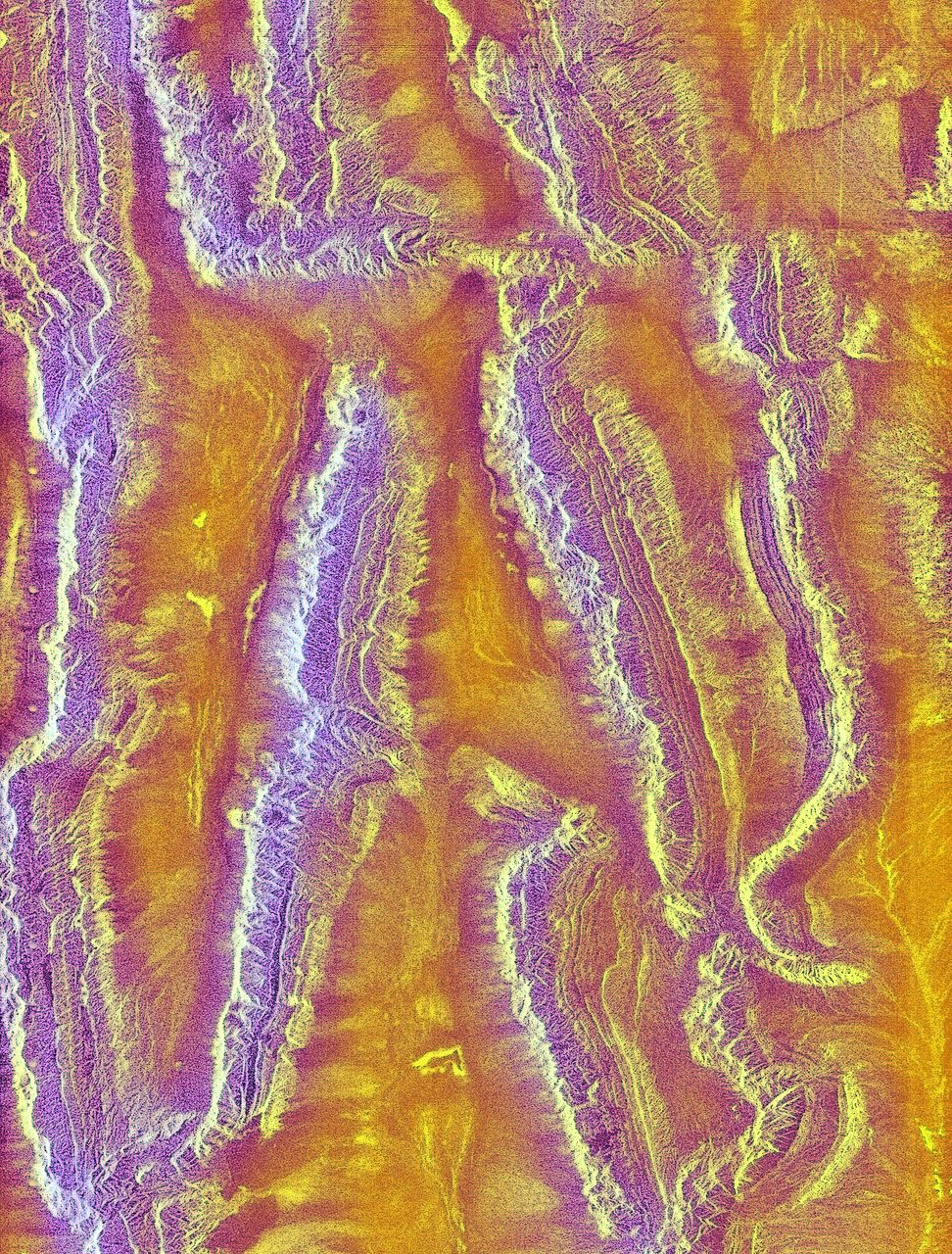
Bright areas in a radar image generally indicate strong backscatter (radar energy scattered back towards the instrument); dark areas indicate weak returns. In Synthetic Aperture Radar (SAR), brightness represents the measured microwave echo, not visible colour: a black roof need not look dark, nor a white field bright.
Calm water usually looks dark because its smooth surface reflects much of the pulse away from the satellite. Rough ground scatters energy in more directions, often sending a stronger echo back. Buildings can appear especially bright through double-bounce reflections, where pulses reflect between a wall and the ground before returning towards the instrument.
The same location can look different as soil moisture, vegetation structure, viewing direction or surface roughness changes. Wind-roughened water may brighten, while a building's orientation can determine whether it produces a strong return. Brightness alone therefore cannot reliably identify a material.
Speckle is a granular interference pattern caused by echoes combining within an image cell; it is not a collection of tiny landscape features. Radar shadow occurs where terrain or buildings block illumination, leaving little or no return. Foreshortening compresses slopes facing the radar; layover occurs when echoes from an elevated feature's top arrive before those from its base, displacing the top towards the instrument in the image.
Orbital Radar's Satellite Library provides context on the wider orbital population, rather than a count of radar imagers. Orbital Radar tracking data records 15,925 active satellites as of 31 October 2026. Orbital Radar's live catalogue contains 31,941 objects, including debris, as of 31 October 2026.
How do wavelength and polarisation change what SAR reveals?
Wavelength determines which parts of vegetation, soil and built structures interact most strongly with radar; polarisation helps explain how those echoes were scattered. X-band, C-band and L-band are microwave wavelength families used by synthetic aperture radar (SAR), ordered here from shorter to longer wavelengths.
X-band tends to interact strongly with leaves and the outer canopy. C-band responds to a mixture of leaves, smaller branches and exposed ground, depending on vegetation density and moisture. L-band can interact with larger branches, trunks and, under suitable conditions, the soil beneath vegetation.
Longer wavelengths can reach deeper into a canopy because small leaves and twigs generally scatter them less strongly. That does not make L-band a means of seeing everything beneath a forest: dense or wet vegetation can still weaken the signal, and the recorded echo combines contributions from different depths.
Polarisation is the orientation of a wave’s electric field, commonly described as horizontal or vertical. Radar instruments can transmit one orientation and measure echoes returning in the same or a different orientation. Comparing these channels helps distinguish scattering mechanisms: tangled branches can change polarisation, while a ground–wall combination can bounce energy back towards the satellite. These are clues, not unique labels for particular objects.
Wavelength alone does not determine image resolution. Antenna design, signal bandwidth (the range of transmitted frequencies), processing and acquisition mode also matter; a longer-wavelength instrument does not automatically produce a less detailed image. Orbital Radar’s satellite library provides a starting point for exploring radar spacecraft.
What can radar satellites reveal that ordinary cameras cannot?
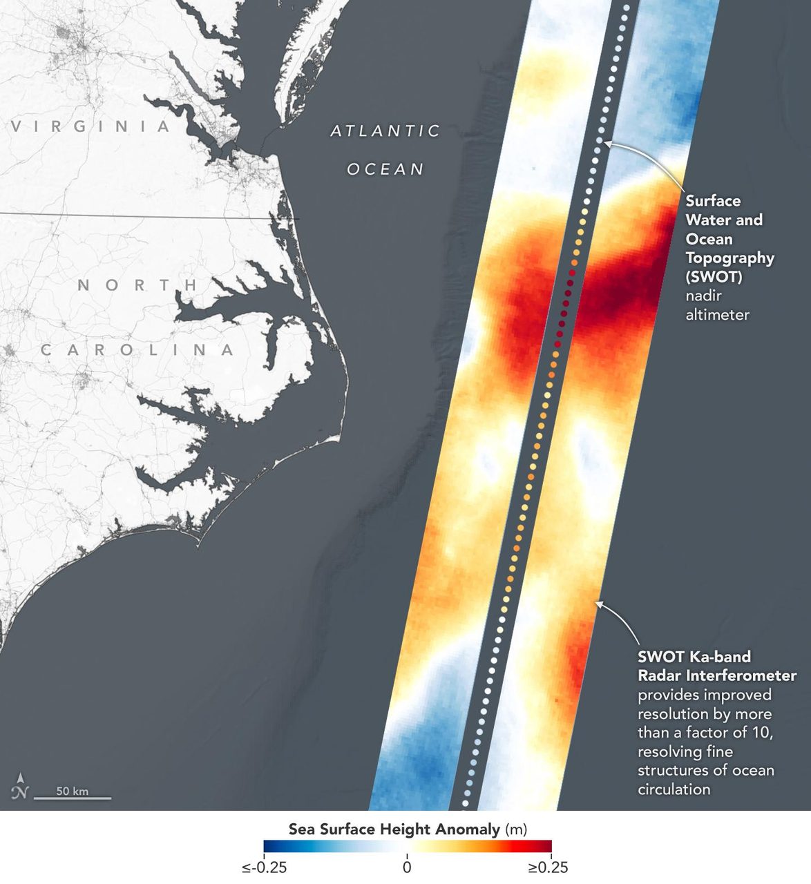
Radar satellites reveal flood extent beneath storm clouds, changes in ice and vegetation, and surface patterns that ordinary cameras may miss. Synthetic aperture radar (SAR) uses microwave echoes rather than reflected sunlight, allowing observations through cloud and in darkness.
During storms, smooth open floodwater often returns a weak echo, helping analysts map inundation against earlier images. Floodwater beneath dense forest can be difficult to detect, while buildings produce strong reflections and radar shadows that complicate urban flood maps.
Over oceans and polar regions, SAR records differences in radar response associated with sea-ice surfaces, glacier features and water roughness. Repeated images can track identifiable glacier features; ocean patterns may suggest winds, waves or currents. These are interpretations of measured echoes, not direct measurements of every underlying condition.
Across farmland and forests, repeat observations reveal changes associated with crop growth, harvesting, forest disturbance and soil moisture. Reliable conclusions require calibration, comparable viewing conditions and local context: wetter soil, changing vegetation and surface roughness can produce overlapping signals.
Optical images add colour and spectral information that helps identify vegetation and surface materials; radar adds sensitivity to structure, roughness and moisture. Orbital Radar’s Earth observation overview places these complementary approaches in context.
Orbital Radar tracking data recorded 15,925 active satellites on 31 October 2026. Orbital Radar’s live catalogue contained 31,941 objects, including debris, on 31 October 2026. Those totals are not counts of radar imagers; the Satellite Library provides context on individual spacecraft.
How can radar measure ground movement from orbit?
Radar satellites measure ground movement by comparing the phase of echoes collected on different passes. Interferometric synthetic aperture radar (InSAR) compares radar observations acquired from different positions or times, using phase—the position within a wave's repeating cycle—to detect differences in the distance between satellite and ground.
With repeat observations of the same area, researchers can map displacement associated with earthquakes, swelling volcanoes, subsidence and moving infrastructure. After accounting for satellite position and terrain, a phase change can indicate that the reflecting surface has moved towards or away from the spacecraft. The measurement is along the radar's line of sight, not automatically a vertical displacement or a complete three-dimensional picture; observations from different viewing directions and ground measurements help resolve that distinction.
Atmospheric interference can delay radar signals and produce patterns that resemble ground movement. Vegetation growth, wind-blown foliage or changes to the surface can also alter the echoes between observations. These changes can cause loss of coherence, meaning the echoes no longer remain sufficiently consistent for reliable comparison, so an apparent displacement pattern needs careful interpretation.
Orbital Radar's satellite library provides context for the spacecraft population, although these totals are not counts of radar missions. There were 15,925 active satellites in orbit as of 31 October 2026, according to Orbital Radar tracking data. Orbital Radar's live catalogue contained 31,941 objects, including debris, on 31 October 2026.
Which radar satellite missions observe Earth today?
Sentinel-1, the RADARSAT Constellation Mission and TerraSAR-X are established civil missions observing Earth with synthetic aperture radar (SAR), alongside commercial spacecraft operated by ICEYE and Capella Space. Their instruments transmit microwave pulses and combine returning echoes along the satellite’s path to build images, rather than relying on reflected sunlight.
Europe’s Sentinel-1 supports broad-area monitoring of sea ice, oceans, land and disasters, including mapping floods and ground deformation. Canada’s RADARSAT Constellation Mission serves maritime surveillance, ecosystem monitoring and disaster management. Germany’s TerraSAR-X provides detailed radar observations for applications including mapping, infrastructure assessment and scientific research.
ICEYE and Capella Space are commercial SAR operators, not names for a single satellite. An operator is the organisation running spacecraft and providing services; a constellation is a coordinated group of satellites; an individual spacecraft is one member with its own identity and orbit. That distinction matters when discussing an operator’s imaging capabilities versus the observations available from a particular satellite.
No single ranking identifies the best mission for every task. Suitability depends on acquisition mode (how the radar collects an image), wavelength, coverage, revisit opportunities and data access. Wide-area flood mapping and detailed inspection of a port, for example, can require different combinations of these capabilities; an orbital pass does not itself guarantee an image was acquired.
Orbital Radar tracking data lists 15,925 active satellites in orbit as of 31 October 2026. That total covers all satellite types, not just radar spacecraft. Individual entries in the Orbital Radar satellite library help distinguish spacecraft identities and orbital information; these should be treated separately from radar instrument specifications and the availability of imagery.
How can you explore radar satellites on Orbital Radar?
Start with Orbital Radar’s Satellite Library to look for a named radar mission or spacecraft, such as Sentinel-1. Use Sentinel-1 as your starting point, then distinguish the mission family from the individual spacecraft described in a record.
Where displayed, the spacecraft name identifies the satellite, the operator identifies the organisation responsible for operating it, and the catalogue identifier distinguishes that orbital object from others. A catalogue identifier is an object reference, not an instrument-status report. Finding a Sentinel-1 spacecraft in orbit does not establish that its radar is collecting data: acquisition depends on instrument availability and the mission’s observation schedule.
Orbital Radar’s live catalogue contains 31,941 objects, including debris, as of 31 October 2026. That total is not a count of working radar satellites: catalogue membership records orbital objects, including debris and spacecraft with purposes other than radar imaging. Identifying an object and establishing its current imaging capability are separate tasks.
Use Satellite Eye as a complementary imagery viewer when exploring Earth observation. Displayed imagery is not evidence of live synthetic aperture radar (SAR) acquisition, and an image on screen should not be treated as a current radar observation without supporting acquisition information. Nor should you assume that radar scenes from every mission, including Sentinel-1, are available in the viewer.
What are the limits of radar satellite images?
Radar satellite images trade fine detail against coverage and observation frequency; they also distort some terrain and cannot identify every object automatically. Synthetic aperture radar (SAR) uses microwave echoes, not a camera-like view.
Finer-detail imaging generally covers a narrower strip, while wider surveys sacrifice detail. A revisit opportunity means a satellite could observe a location, not that an image is guaranteed: tasking priorities, operating constraints and recording capacity affect acquisitions.
Orbital Radar tracking data lists 15,925 active satellites as of 31 October 2026. That population is not a measure of radar imaging availability: many satellites perform other functions.
Side-looking radar geometry can compress slopes, place mountaintops ahead of their bases in an image, or leave terrain behind ridges in radar shadow. Buildings can overlap surrounding streets in the radar view, complicating urban interpretation. Observing from another direction can reveal hidden surfaces, although the resulting image will look different.
Orbital Radar's live catalogue contains 31,941 objects, including debris, as of 31 October 2026. Catalogue coverage does not imply continuous imaging: cloud-independent radar observations still require a suitable pass, followed by data transmission and processing before delivery.
Use this checklist when interpreting an image; Orbital Radar's Satellite Library can help identify the spacecraft:
- Identify the sensor, imaging mode and acquisition time.
- Understand viewing direction, slopes and likely radar shadows.
- Compare like-for-like observations with similar geometry and settings.
- Use optical images or ground evidence where appropriate: a bright radar return alone does not establish an object's identity.
Key takeaways
- Radar satellites transmit microwave pulses and measure returning echoes, allowing observations without sunlight and through most cloud cover.
- Synthetic aperture radar combines echoes collected along a satellite's path to create an effective antenna much larger than its physical antenna.
- Radar images reveal scattering properties rather than visible colours, supporting flood mapping, surface-change detection and ground-motion measurements.
- Sentinel-1 and other radar missions complement optical imagery, but their usefulness depends on viewing geometry, acquisition choices and careful interpretation.
Frequently Asked Questions
Can radar satellites see people or read number plates?
Are radar satellite images free to download?
Do radar satellites transmit harmful radiation to people on Earth?
What is the difference between SAR and lidar?
Can radar satellites detect underground tunnels?
📎 Cite this article · data available
Orbital Radar Newsroom. (2026). How Do Radar Satellites Work? SAR Explained. Orbital Radar. https://orbitalradar.com/blog/how-radar-satellites-see-through-clouds"How Do Radar Satellites Work? SAR Explained." Orbital Radar, 31 October 2026, https://orbitalradar.com/blog/how-radar-satellites-see-through-clouds.@misc{orbitalradar_how_radar_satellites_see_through_clouds,
title = {How Do Radar Satellites Work? SAR Explained},
author = {{Orbital Radar}},
year = {2026},
howpublished = {\url{https://orbitalradar.com/blog/how-radar-satellites-see-through-clouds}}
}