How accurate are satellite predictions? A practical guide
Satellite predictions are estimates, not exact timetables. Understand how orbital data becomes a predicted pass, why errors grow and what makes a forecast trustworthy.
| Active satellites | 16,712 |
| Starlink active | 9,790 |
| Catalogued objects | 32,151 |
| Active close approaches | 18 |
| People in space | 10 |
Satellite predictions based on public orbital elements and SGP4 (Simplified General Perturbations, an orbit-prediction model) typically have kilometre-scale positional accuracy, but no universal accuracy guarantee. Their usefulness depends on how recently the orbit was measured, whether the satellite has manoeuvred, and whether you need a broad viewing window or precise pointing.
Orbital Radar tracking data lists 16,712 active satellites as of 20 November 2026. Predicting their movements starts with observations, which become orbital elements: numbers describing an orbit, commonly published as a TLE (two-line element set). SGP4 projects that orbit forward, and the predicted position is then converted into a view from the observer’s location.
Knowing where a satellite should be is not the same as knowing whether you will see it. Visibility also depends on sunlight reaching the spacecraft, the darkness of your sky, weather and obstructions. Orbital Radar’s pass predictor helps translate orbital predictions into local viewing opportunities; this guide explains how to judge whether a prediction is accurate enough for your purpose.
What information is needed to predict a satellite's position?
Predicting a satellite’s position requires an identified object, suitable orbital data, a propagation model (a calculation that advances an orbit through time), and the time of interest. A local prediction also needs the observer’s location: latitude, longitude and height above sea level.
Tracking observations constrain an estimated orbit; they do not continuously reveal an object’s exact position. Measurements collected at different times help determine its path, but uncertainty remains between observations and when predicting ahead.
Orbital elements are parameters describing an orbit’s shape, orientation and the satellite’s place along it at a reference time. A model uses these parameters to calculate positions. An ephemeris is a series of predicted positions over time, rather than the orbital elements used to generate them.
Orbital Radar’s live catalogue contained 32,151 tracked objects, including debris, as of 20 November 2026. Use the Orbital Radar satellite library to confirm the object’s catalogue identifier and mission details rather than relying on a familiar name alone: similarly named satellites can occupy different orbits.
Orbital Radar’s catalogue coverage of 32,151 objects on 20 November 2026 describes the tracking inventory, not prediction precision. Accuracy depends on the observations, orbital data and model used for the particular object.
What does a TLE tell you about a satellite's orbit?
A two-line element set, or TLE, is a compact representation of a satellite’s estimated orbit, designed for use with a compatible propagation model (software that calculates how an orbit evolves). It is not an exact position fix, despite the many digits printed in its fields.
Orbital Radar tracking data lists 16,712 active satellites as of 20 November 2026. For any satellite whose prediction uses a TLE, the key timestamp is its epoch: the reference time for the orbital estimate, not when a website downloaded or displayed it.
Inclination describes the orbit’s tilt relative to Earth’s equator. Eccentricity describes its shape: zero means circular, while higher values indicate increasingly elongated ellipses. Mean motion, expressed in revolutions per day, describes the average rate of orbital motion.
These are model-dependent mean elements: quantities representing an orbit with certain short-period variations averaged out, interpreted through the intended model, usually SGP4 (Simplified General Perturbations). They are neither an exact instantaneous position nor a complete uncertainty assessment; extra decimal places do not establish accuracy.
Orbital Radar’s live catalogue contains 32,151 objects, including debris, as of 20 November 2026. When checking an individual object in the Orbital Radar Satellite Library, prioritise the element set’s epoch over its apparent numerical precision: a recent download can still contain an older orbital estimate. The detailed guide to TLEs explains the format and how to read its timestamp.
How does SGP4 turn orbital elements into a predicted position?
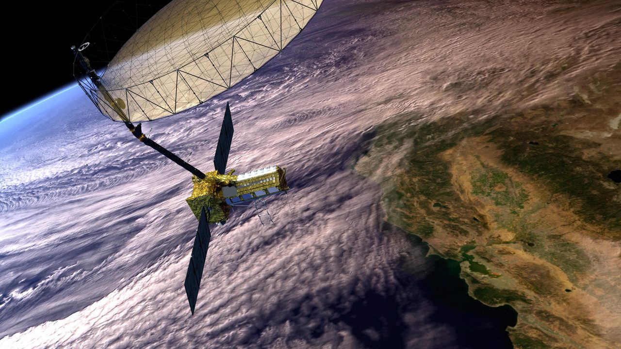
SGP4 (Simplified General Perturbations) turns a two-line element set (TLE) into a predicted satellite position and velocity at a requested time. This process is called propagation: calculating how an estimated orbit evolves through time, forwards or backwards from the element set’s reference time.
The model accounts for Earth’s equatorial bulge, atmospheric drag and relevant lunar and solar effects. These are mathematical approximations, not a perfect reconstruction of every force acting on a spacecraft. Orbital Radar’s SGP4 glossary entry explains the model used across public satellite tracking.
A TLE’s orbital elements are fitted for use with this model, rather than being interchangeable inputs for any orbit simulator. Feeding them directly into a different simulator can introduce errors even if that simulator describes physical forces in greater detail: the input assumptions and propagation method must match.
The resulting position and velocity use an Earth-centred reference frame (a coordinate system). They must then be transformed into the coordinates needed by a map or observer, rather than treated directly as latitude, longitude or a direction in the sky.
Orbital Radar tracking data lists 16,712 active satellites as of 20 November 2026. Orbital Radar’s live catalogue contains 32,151 objects, including debris, as of 20 November 2026. SGP4 supports broad public tracking and initial screening at this scale, typically with kilometre-scale accuracy that worsens as elements age; precision operational predictions use other tracking data and methods suited to the task.
How accurate are satellite positions, pass times and sky tracks?
Satellite positions predicted with SGP4 (Simplified General Perturbations) typically have kilometre-scale accuracy, but that is a broad description, not a guaranteed error bound for every satellite or orbital element set. Position accuracy, pass-timing accuracy and sky-track accuracy describe different things; none can be substituted directly for another.
Position error is the spatial separation between a satellite’s predicted and actual locations at the same moment. Along-track error puts it ahead of or behind its predicted location along the orbit, while errors across the orbit or towards or away from Earth can shift its apparent path.
Pass-timing error is the difference between the predicted and actual time of a specified event, such as crossing a chosen elevation above the horizon. Along-track error can make a satellite arrive early or late, but the conversion into seconds depends on its motion and the observing geometry: there is no universal conversion.
Angular error is the difference between predicted and actual directions in the sky. The same sideways positional offset produces a larger angular error for a nearby satellite than for a distant object; an offset along the observer’s line of sight has a different effect.
For ordinary naked-eye observing, a prediction can remain useful even when the satellite does not follow its exact plotted track. Narrow-field imaging is less forgiving, while solar or lunar transits require especially close alignment: Orbital Radar’s satellite transit predictions concern a much tighter observing target than simply finding a satellite in the sky, without implying a universal accuracy threshold.
Why do satellite predictions become less reliable with age?

Satellite predictions become less reliable with age because uncertainty in the starting orbit and imperfections in force modelling accumulate as the calculation moves away from the epoch—the time the orbital data describe. A TLE (two-line element set) is an approximate orbital description, not a perfectly measured starting point.
Orbital Radar's live catalogue lists 16,712 active satellites as of 20 November 2026. Their predictions commonly use SGP4 (Simplified General Perturbations), which models Earth's equatorial bulge, atmospheric drag and gravitational effects from the Sun and Moon. Its typical kilometre-scale accuracy degrades as the elements age, but not at a universal rate.
Atmospheric drag is variable resistance from the upper atmosphere. Its strength depends on atmospheric conditions and the satellite's altitude, shape and orientation. If the resistance differs from the model's assumptions, the predicted orbit gradually diverges from the actual trajectory.
Small errors in orbital period—the time taken to complete an orbit—can accumulate into substantial along-track displacement: the satellite arrives ahead of or behind its predicted position. Error need not grow steadily or linearly, because the forces themselves change.
Orbital Radar tracking data cover 32,151 catalogued objects as of 20 November 2026. No single TLE expiry time suits that varied population: low or decaying orbits generally warrant more caution than comparatively stable trajectories.
Element-set age and forecast horizon are different. When consulting the Orbital Radar pass predictor, remember that a future pass may already rely on older data: the relevant interval runs from the elements' epoch to the predicted event, not merely from your request.
What happens to predictions when a satellite manoeuvres?
An unmodelled manoeuvre changes a satellite’s trajectory, so predictions based on its previous orbit can become misleading until updated observations are incorporated. A thruster firing changes velocity; even a small change can accumulate into a significant difference between the predicted position and where the satellite actually travels.
Orbital Radar tracking data lists 1,195 Starlink satellites raising their orbits as of 20 November 2026. Orbital Radar tracking data lists 221 Starlink satellites deorbiting as of 20 November 2026. These are counts of satellites in changing orbital phases, not measurements of prediction accuracy.
During orbit raising, repeated thrusting gradually changes the orbit’s height and the time taken to circle Earth. During a controlled descent, deliberate orbit lowering can also change the trajectory, with atmospheric drag becoming more influential at lower altitudes. Both situations deserve extra caution because a prediction based on an earlier trajectory may no longer describe the satellite’s motion.
A recently issued element set (the numerical description of an orbit) is helpful, but does not guarantee that it captures a subsequent manoeuvre or all ongoing thrust. Orbital Radar’s satellite manoeuvre tracker provides context for investigating orbital changes, rather than assurance that every manoeuvre is detected immediately. Treat predictions during active orbit changes as provisional, especially when precise timing or pointing matters.
How is a predicted orbit turned into a visible satellite pass?
A predicted orbit becomes a pass prediction by calculating the satellite’s position relative to your location as Earth rotates. This gives azimuth (compass direction) and elevation (angle above the horizon), both changing as the satellite and observer move.
Geometric rise and set occur where the predicted track crosses an ideal, unobstructed horizon. Buildings, hills or a restricted observing horizon can delay your first sighting and end it early; maximum elevation, the pass’s highest angle, helps indicate whether the track clears obstructions.
For ordinary reflected-light observations, the satellite must be sunlit and the sky sufficiently dark. An overhead satellite may be invisible inside Earth’s shadow, while an illuminated satellite may disappear against bright twilight.
Orbital uncertainty concerns where the satellite will be and when; brightness uncertainty concerns how much reflected sunlight reaches you. Cloud cover can hide an accurately predicted pass, while changes in the satellite’s orientation can alter its brightness without changing its orbit.
The useful observing window is therefore the visible portion, not necessarily the whole interval between geometric rise and set. Use maximum elevation alongside illumination and local obstructions when interpreting times in the Orbital Radar pass predictor.
Orbital Radar tracking data lists 16,712 active satellites as of 20 November 2026. Orbital Radar’s live catalogue contains 32,151 objects, including debris, as of 20 November 2026; catalogue membership alone does not establish naked-eye visibility.
How can you check a satellite prediction on Orbital Radar?
Open Orbital Radar’s pass predictor, set your observing location and select the intended satellite. Confirm the prediction date and displayed time zone before saving the forecast; a correct prediction for the wrong site or local time will not guide your observation.
Check the object’s identity in the Satellite Library at /library, matching its catalogue identifier rather than relying on a similar name. Orbital Radar tracking data lists 16,712 active satellites as of 20 November 2026. Orbital Radar’s live catalogue contains 32,151 objects, including debris, as of 20 November 2026.
Read the predicted direction alongside elevation (angle above the horizon) and the pass window’s start and end times. Note where the satellite should appear and where its track reaches its highest point. Use Groundlink for look angles: azimuth (compass direction), elevation and range (distance from your site) at the selected time.
Where orbital elements include an epoch, read it as the reference time for that orbital description—not the time the page refreshed. A freshly loaded page does not necessarily mean the underlying orbit was recently measured.
Recalculate close to your observing session and compare the latest result with your saved forecast. Agreement is reassuring, but not independent proof of accuracy: both calculations may use the same orbital elements and prediction method.
Begin watching before the predicted event from an unobstructed location. Record observed timing or track differences, along with cloud, obstructions and clock settings; a missed pass alone does not establish an orbital prediction error.
How can you judge whether a prediction is accurate enough?
A prediction is accurate enough when its uncertainty is smaller than the margin your observation can tolerate. Judge it against the task and the consequences of being wrong, not a universal accuracy score.
- Purpose: are you scanning the sky, taking narrow-field images, watching a brief transit across the Sun or Moon, or pointing an antenna?
- Data age: how old is the TLE (two-line element set describing an orbit), rather than the app’s last refresh?
- Forecast horizon: how far beyond that orbital-data epoch are you predicting?
- Orbital behaviour: could manoeuvres or changing atmospheric drag have invalidated the forecast?
- Consequences: would a miss mean trying again, losing a rare observation, or compromising operations?
A broad visual search can accommodate an early arrival or an offset track because you can watch a wide area. Narrow-field imaging, brief transits and precise antenna pointing leave much less room for error; a useful skywatching forecast may be inadequate for these tasks.
Covariance is a mathematical description of uncertainty, including how errors in different components of position and velocity are related. An ordinary TLE does not itself provide a complete confidence region, so its displayed precision is not a guarantee of positional accuracy.
Agreement between apps is not necessarily independent validation: they may share orbital data and SGP4 (Simplified General Perturbations), the standard prediction algorithm. Its typical kilometre-scale accuracy degrades as the TLE ages.
Public pass forecasts, including Orbital Radar’s pass predictor, are not substitutes for collision-risk assessment, which requires uncertainty information and appropriate operational processes. Match your tolerance to the available evidence; when the margin is too small or the stakes too high, seek better-supported predictions or change the plan.
Key takeaways
- Public TLE-and-SGP4 predictions typically offer kilometre-scale positional accuracy, not a universal guarantee of precise timing or pointing.
- Prediction reliability depends on the element epoch, forecast horizon, atmospheric conditions and any manoeuvres since the orbit was estimated.
- A predicted pass describes geometry; actual visibility also depends on illumination, sky brightness, weather and the local horizon.
- Use Orbital Radar's pass predictor near the observing time and judge the forecast against the precision your observation requires.
Frequently Asked Questions
Can satellite predictions work without an internet connection?
Does GPS use TLEs to calculate your location?
Why do two satellite-tracking apps show different pass times?
Can a satellite prediction tell me exactly how bright the ISS will look?
Are satellites in geostationary orbit easier to predict?
Cite this article
Pick a style, then copy it or download it for your reference manager.Orbital Radar. (2026, November 20). How accurate are satellite predictions? A practical guide. Retrieved November 20, 2026, from https://orbitalradar.com/blog/how-satellite-predictions-work
“How accurate are satellite predictions? A practical guide.” Orbital Radar, 20 Nov. 2026, orbitalradar.com/blog/how-satellite-predictions-work. Accessed 20 Nov. 2026.
Orbital Radar (2026) How accurate are satellite predictions? A practical guide. Available at: https://orbitalradar.com/blog/how-satellite-predictions-work (Accessed: 20 November 2026).
Orbital Radar. “How accurate are satellite predictions? A practical guide.” Last modified November 20, 2026. https://orbitalradar.com/blog/how-satellite-predictions-work.
@misc{orbitalradar_blog_how_satellite_predictions_work,
  author       = {{Orbital Radar}},
  title        = {How accurate are satellite predictions? A practical guide},
  year         = {2026},
  month        = nov,
  howpublished = {\url{https://orbitalradar.com/blog/how-satellite-predictions-work}},
  url          = {https://orbitalradar.com/blog/how-satellite-predictions-work},
  urldate      = {2026-11-20},
  note         = {Accessed 2026-11-20}
}
TY - ELEC AU - Orbital Radar, TI - How accurate are satellite predictions? A practical guide PY - 2026 DA - 2026/11/20 PB - Orbital Radar UR - https://orbitalradar.com/blog/how-satellite-predictions-work Y2 - 2026/11/20 LA - en ER -
Live figures change, so keep the date you accessed the page. How to cite Orbital Radar