How Are Satellites Tested Before Launch?
Satellites face simulated launch loads and space conditions before flight. Thermal vacuum, vibration and acoustic tests expose faults that could otherwise end a mission.
| Active satellites | 15,873 |
| Starlink active | 10,082 |
| Catalogued objects | 31,820 |
| Predicted re-entries | 21 |
| Active close approaches | 19 |
| People in space | 10 |
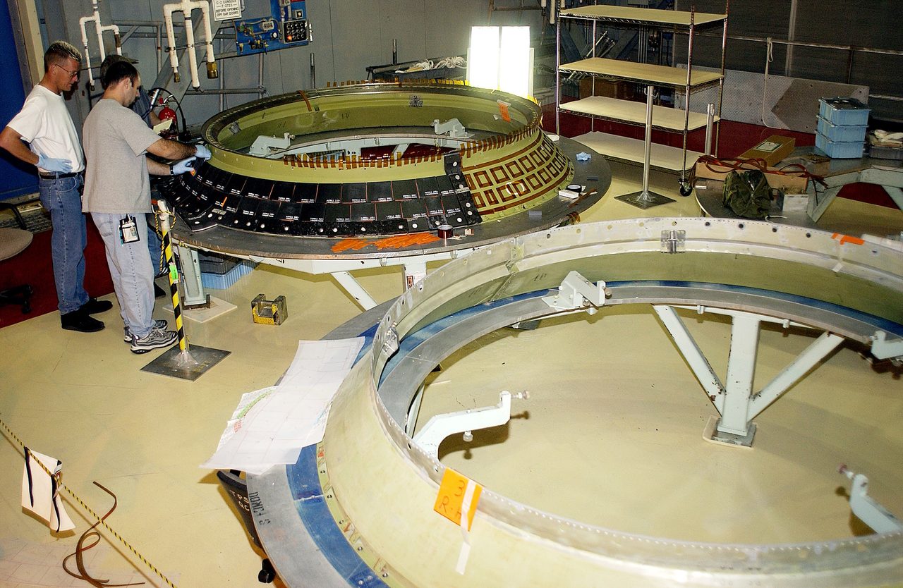
Satellites are tested before launch through functional checks and controlled exposure to vibration, intense sound, mechanical shock, and the vacuum and temperature extremes expected during their missions. Engineers compare performance before, during and after these tests to find structural weaknesses, electrical faults and thermal problems while repairs are still possible.
Orbital Radar tracking data lists 15,873 active satellites in orbit as of 19 October 2026. That figure shows the scale of satellite operations, not that every spacecraft follows the same testing programme: requirements depend on the mission, design and launch conditions. Orbital Radar’s satellite library provides context on the spacecraft operating in orbit.
The central distinction is that testing demonstrates compliance with defined mission requirements; it does not prove that a satellite cannot fail. A successful programme gives engineers evidence that a spacecraft can withstand specified conditions and perform its intended tasks, while leaving uncertainties about conditions and combinations of faults that tests cannot fully reproduce.
What does a satellite testing programme involve?
A satellite testing programme turns mission requirements into checks that its design and flight hardware can survive launch and operate in the intended orbit. Engineers derive those checks from the orbit’s environment, the operating lifetime, the spacecraft’s materials and configuration, and loads specified for the chosen launch vehicle.
Qualification testing demonstrates that a design withstands specified conditions with margins beyond expected operating or launch conditions. Acceptance testing checks the workmanship and performance of flight hardware: the satellite and components that will actually fly.
Protoflight testing uses flight hardware to provide design-verification evidence as well, under a carefully selected programme. Engineers balance test severity and duration against the risk of damaging that hardware; the approach varies with design heritage, mission risk, available hardware and programme constraints.
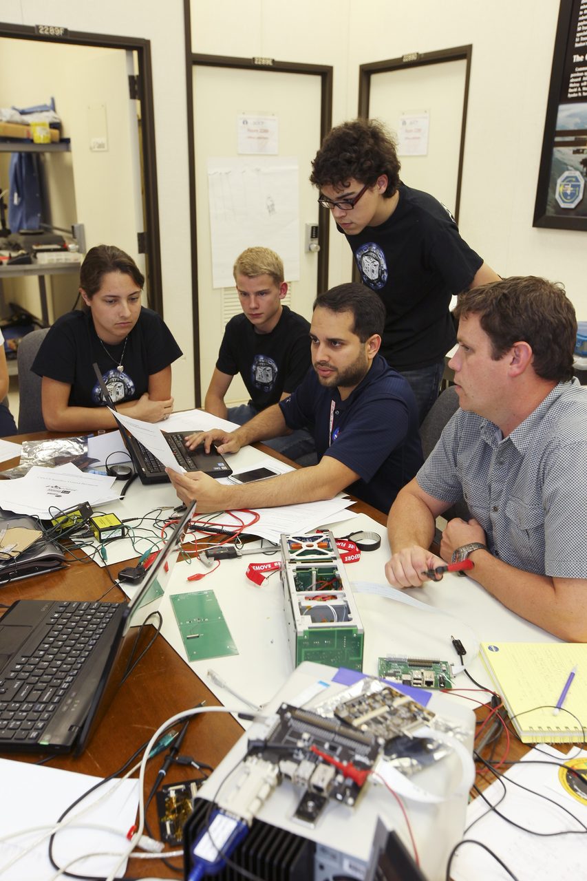
Functional checks run throughout assembly, integration and testing, as components become a complete spacecraft. Engineers record measurements against a baseline—a reference set of results—so changes after handling or environmental exposure can be investigated rather than judged from memory.
Orbital Radar tracking data lists 15,873 active satellites as of 19 October 2026. Orbital Radar’s live catalogue contains 31,820 objects, including debris, as of 19 October 2026. Those fleet-wide figures provide context, while the satellite library helps distinguish individual missions; neither figure establishes how a particular spacecraft was tested.
How do vibration tests simulate a rocket launch?
Vibration tests simulate a rocket launch by driving controlled motion through a satellite’s mounting points, reproducing specified mechanical loads. An electrodynamic shaker uses electromagnetic force to move a platform; a fixture transfers that motion into the satellite or component while holding it in the required orientation.
Sine vibration sweeps through individual frequencies, helping engineers identify resonance (an amplified response near a structure’s natural frequency). Random vibration applies a spectrum of frequencies together, representing the broadband shaking experienced during launch. Both follow prescribed test profiles rather than simply shaking the hardware as hard as possible.
Accelerometers (sensors that measure acceleration) record motion at the mounting interface and selected locations on the hardware. Engineers use these measurements to control the shaker and limit excessive responses. The fixture and laboratory mounting arrangement can introduce their own resonances, so controls must prevent unrealistic loads from damaging hardware or producing misleading results.
Testing can expose loose fasteners, cracked brackets, weak electrical joints and poorly restrained wiring. The specification depends on the selected rocket, mounting interface and mission requirements; Orbital Radar’s launch vehicle directory provides launcher context, not mission-specific test limits.
Orbital Radar tracking data lists 15,873 active satellites as of 19 October 2026. Starlink accounts for 10,082 active satellites as of 19 October 2026, according to Orbital Radar tracking data. These fleet counts do not establish which vibration tests any individual satellite completed.
Why do satellites need acoustic and shock tests?
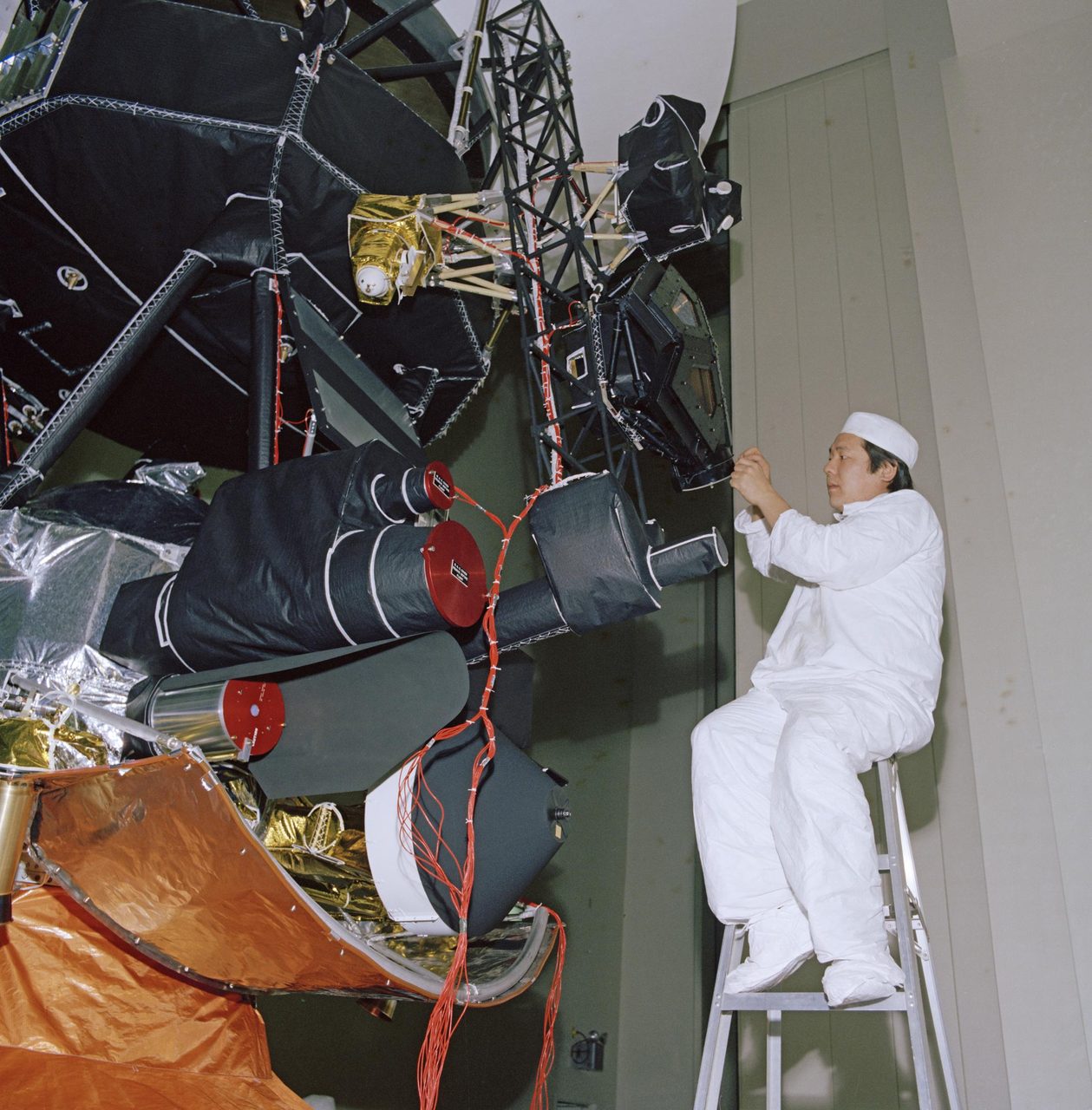
Satellites need acoustic and shock tests because launch noise and sudden mechanical events can damage hardware in ways that mounting-point vibration tests do not reproduce. Acoustic testing exposes the spacecraft to an intense sound field representative of launch, including pressure fluctuations inside the payload fairing (the rocket’s protective enclosure).
Sound pressure acts across exposed surfaces, whereas interface vibration enters through the spacecraft’s attachment points. Large panels and lightweight structures can respond differently to these inputs, so passing one test does not demonstrate resistance to the other. Orbital Radar tracking data recorded 15873 active satellites in orbit on 19 October 2026.
Mechanical shock is a brief disturbance caused by events such as stage separation or spacecraft release. Pyroshock is the brief, high-frequency response associated with pyrotechnic devices, such as explosive release bolts. Engineers select representative shock sources or simulators according to the hardware and mission, rather than applying one universal test.
Connectors can lose electrical contact, optical mounts can shift, release mechanisms can suffer damage and brittle components can crack. Acoustic, vibration and shock tests therefore address related but non-interchangeable risks: distributed sound pressure, motion transmitted through attachments and sudden mechanical transients.
Orbital Radar’s launch vehicle guide provides context on the rockets carrying these payloads, but does not establish an individual spacecraft’s test requirements. Orbital Radar’s live catalogue contained 31820 objects, including debris, on 19 October 2026; that catalogue count does not indicate which qualification tests each object underwent.
What happens during a thermal vacuum test?
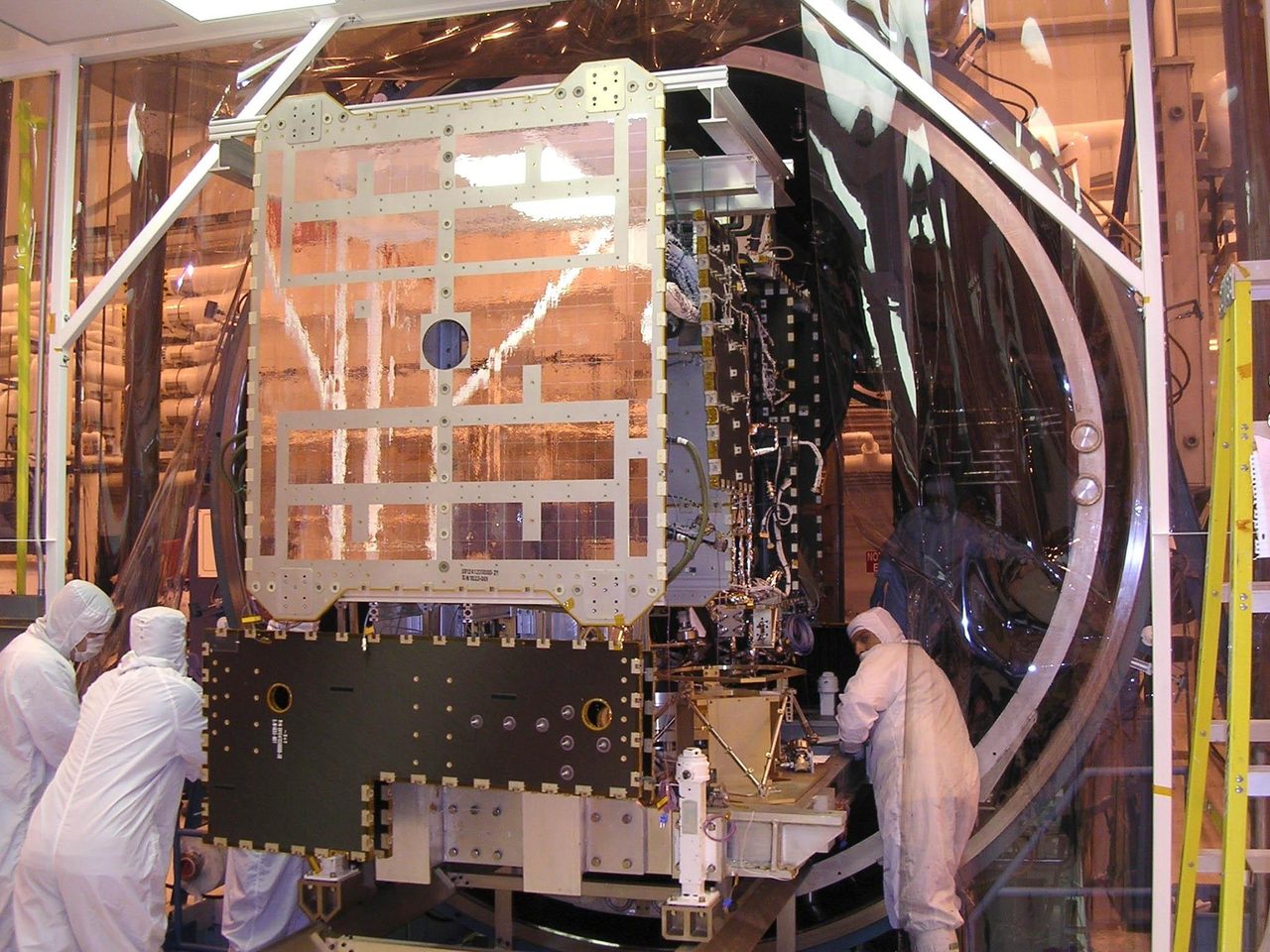
Thermal vacuum testing operates satellite hardware inside a low-pressure chamber while controlling its thermal environment to represent relevant conditions in space. Engineers use cooled chamber surfaces and controlled heat inputs to test how the hardware manages heat; the chamber does not recreate every feature of space.
In a vacuum, spacecraft cannot rely on surrounding air to carry heat away. Heat travels through structures by conduction (transfer through materials) and leaves surfaces by radiation (energy emitted as electromagnetic waves).
Orbital Radar tracking data lists 15,873 active satellites in orbit as of 19 October 2026. Each spacecraft’s intended orbit, orientation and operating modes help determine which hot and cold conditions its test programme should represent.
Engineers operate equipment at hot and cold conditions and check its functions during temperature transitions. Expansion and contraction can expose intermittent electrical connections, while measurements can reveal inadequate heater control or overheating electronics.
Thermal balance testing measures temperatures under carefully controlled, relatively steady conditions to assess predicted heat flows and refine thermal models. Thermal cycling repeatedly changes temperatures to expose temperature-related weaknesses; it serves a different purpose from checking whether heat-flow predictions match measurements.
Vacuum also encourages outgassing (the release of material vapours), which can leave deposits on sensitive optical surfaces. Material selection, cleaning, controlled handling and contamination monitoring help protect lenses, mirrors and detectors.
Orbital Radar’s live catalogue contains 31,820 objects, including debris, as of 19 October 2026. Its satellite library provides context on spacecraft in orbit, but a catalogue entry alone does not establish which thermal vacuum tests a satellite completed.
How are satellite electronics, software and radio links checked?
Engineers check satellite electronics, software and radio links with end-to-end functional tests: ground equipment sends commands, onboard computers process them, instruments respond, and telemetry (engineering data returned by the spacecraft) confirms the results. Radio checks verify command reception and data transmission through representative ground equipment, including whether messages remain usable under expected signal conditions.
Electromagnetic compatibility testing checks that equipment neither produces unacceptable electrical or radio interference nor becomes unduly susceptible to it. Engineers operate subsystems together to look for problems such as a transmitter disrupting a sensitive instrument or corrupting data.
Power-system checks reproduce representative operating modes, from low-demand standby to power-intensive instrument use and transmission. They verify battery charging, discharge limits, protective controls and transitions between solar-array power and batteries, checking that essential electronics remain supplied.
Engineers inject faults or simulate failures, such as missing sensor readings or interrupted communications, to test software responses. These exercises check entry into safe mode (a protective operating state that preserves essential functions) and recovery logic, but cannot reproduce every possible fault or combination of failures.
Radiation assurance relies on component-level irradiation tests and analysis, distinct from whole-spacecraft environmental testing. Radiation-tolerant part selection, shielding and software protections also help limit damage and recover from radiation-induced errors.
Orbital Radar tracking data lists 15873 active satellites as of 19 October 2026. Orbital Radar tracking data lists 31820 catalogued objects, including debris, as of 19 October 2026. The Orbital Radar satellite library provides spacecraft context; these catalogue totals are not evidence that any particular testing programme was completed.
How do engineers test solar panels and deployment mechanisms?
Engineers test solar panels, antennas and other deployable structures by checking that they release from launch restraints, move through their intended travel and latch securely. A failed deployment can leave a satellite without enough electrical power or unable to point its communications antenna correctly.
Gravity-offload equipment supports the hardware with counterweights, suspension systems or other supports during deployment. It approximates aspects of weightlessness by reducing gravitational loading, but cannot reproduce orbital conditions completely; support friction and residual forces must be considered.
Teams check hinges, motors, cable routing, release devices and position sensors, looking for binding, snagging, inadequate driving force or misleading deployment indications. Relevant hot and cold conditions are included where practical because thermal expansion, contraction and lubricant behaviour can change how mechanisms operate.
Some demonstrations use engineering hardware or representative mechanisms because repeated operation can wear components, while single-use release devices require replacement after firing. After testing, engineers inspect the hardware, reset mechanisms using approved procedures and verify the final stowed configuration, including restraints, cable clearances and sensor indications. This prevents testing itself from leaving a hidden launch risk.
Orbital Radar tracking data lists 15873 active satellites as of 19 October 2026. Starlink accounts for 10082 active satellites as of 19 October 2026, according to Orbital Radar tracking data. Orbital Radar’s satellite library provides catalogue context, rather than evidence that an individual deployment mechanism passed testing.
What failures can pre-launch testing catch, and what can it miss?
Pre-launch testing can expose weak designs and manufacturing mistakes, but it cannot reproduce every condition a satellite will encounter. Vibration may loosen a connector until power becomes intermittent; thermal expansion may open a poorly bonded electrical joint; a deployment cable may snag as a panel moves.
A design weakness can affect every unit built to the same specification, whereas a workmanship defect arises during manufacture or assembly. Investigators compare sensor measurements and electrical logs, inspect suspect parts and seek repeatable evidence linking the symptom to its cause, rather than assuming the last component to fail caused the problem.
Corrective action might involve securing a connector, changing a joint or rerouting a cable. Engineers then repeat relevant tests and perform regression testing—checks that the repair or design change has not introduced another problem elsewhere.
Orbital Radar's live catalogue lists 31,820 objects, including debris, as of 19 October 2026. Passing environmental tests does not guarantee immunity to orbital debris, operational mistakes or every radiation effect.
Remaining blind spots include rare combinations of events, long-term material degradation and imperfect models of launch and orbital environments. Ground equipment also introduces constraints: panel supports and simulated signals cannot reproduce every interaction between a freely orbiting spacecraft and its surroundings.
Orbital Radar tracking data records 15,873 active satellites as of 19 October 2026. The Orbital Radar satellite library provides context on spacecraft in orbit, but those fleet figures do not establish whether an individual satellite's testing uncovered every weakness.
What checks happen after testing and before launch?
Engineers approve a satellite for flight by checking test results against requirements, investigating anomalies and documenting any accepted departures. Unresolved findings can delay shipment or launch if compliance or safety cannot be demonstrated.
Each anomaly needs a recorded disposition: corrective work, further testing or formally justified acceptance by the responsible authorities. According to Orbital Radar tracking data, 15,873 satellites were active in orbit on 19 October 2026.
After environmental testing and transport, teams repeat selected functional checks and inspect for damage, loose connections and contamination. Cleanroom handling, protective covers and controlled cleaning protect sensitive surfaces. Configuration verification confirms that hardware, flight software, settings and documentation match the approved design.
Spacecraft–rocket compatibility checks cover mounting geometry, fasteners, electrical connections and separation-system requirements. Teams verify power and command interfaces, separation clearances and safeguards against unintended release. Orbital Radar’s launch vehicle pages provide context on the rockets carrying these spacecraft.
Fuelling, battery charging or activation, and other hazardous operations depend on spacecraft design and follow mission-specific procedures. Not every satellite carries propellant, and battery preparation varies with its chemistry and launch constraints.
According to Orbital Radar tracking data, 31,820 objects, including debris, were catalogued on 19 October 2026. A technical readiness review assesses evidence that the spacecraft and supporting operations meet flight criteria; it does not guarantee mission success. Open findings must be resolved or formally accepted before the relevant approval can proceed.
Can you check a satellite's testing status on Orbital Radar?
You can look for a spacecraft and its listed launch on Orbital Radar, but these records do not confirm its testing status. Start with the Satellite Library to find the spacecraft, then check the Launch Schedule for its listed launch. Availability and detail vary between missions, and a mission's test status may remain publicly unconfirmed.
For this article dated 19 October 2026, Orbital Radar's live catalogue lists 31,820 objects, including debris. Catalogue totals describe tracked objects, not a database of test certificates. A catalogue entry or scheduled launch is not evidence that thermal vacuum, acoustic or vibration testing has been completed.
When assessing a public testing claim, look for the spacecraft or test article (the hardware used in the test), the test performed, its completion status and any remaining work. Check whether the announcement concerns flight hardware or a separate engineering model. A statement that testing has begun, or that hardware has arrived at a facility, reports progress rather than completion.
Orbital Radar's live catalogue total of 31,820 objects on 19 October 2026 does not establish any spacecraft's test status. A progress announcement is not the same as detailed engineering results showing the conditions applied, measurements recorded and acceptance criteria met. Where those details are unavailable, distinguish what has been publicly announced from what remains unconfirmed, rather than treating a launch listing as proof of readiness.
Key takeaways
- Satellites undergo functional and environmental checks tailored to their mission, design and launch vehicle rather than a universal test sequence.
- Vibration, acoustic and shock tests probe different mechanical risks, while thermal vacuum testing checks behaviour under low pressure and controlled thermal conditions.
- Testing can expose weak structures, electrical faults, thermal problems and deployment failures, but it cannot reproduce every orbital hazard or guarantee success.
- Orbital Radar's Satellite Library and Launch Schedule provide mission context, but neither a listing nor a launch date confirms that a spacecraft has passed its tests.
Frequently Asked Questions
How long does NASA satellite testing take before launch?
Are CubeSats tested before launch too?
Do satellite thermal vacuum tests recreate the radiation environment in low Earth orbit?
Does a satellite need more testing if it changes from Ariane to Falcon?
Who sets satellite testing requirements: NASA, ESA or the launch provider?
📎 Cite this article · data available
Orbital Radar Newsroom. (2026). How Are Satellites Tested Before Launch?. Orbital Radar. https://orbitalradar.com/blog/how-are-satellites-tested-before-launch"How Are Satellites Tested Before Launch?." Orbital Radar, 19 October 2026, https://orbitalradar.com/blog/how-are-satellites-tested-before-launch.@misc{orbitalradar_how_are_satellites_tested_before_launch,
title = {How Are Satellites Tested Before Launch?},
author = {{Orbital Radar}},
year = {2026},
howpublished = {\url{https://orbitalradar.com/blog/how-are-satellites-tested-before-launch}}
}