South Atlantic Anomaly: Why Satellites Glitch
A weak patch in Earth's magnetic shield brings trapped radiation into the paths of low-orbiting spacecraft. Here is why satellites glitch and how operators protect them.
| Active satellites | 16,614 |
| Starlink active | 9,903 |
| Catalogued objects | 32,009 |
| Active close approaches | 24 |
| People in space | 10 |
The South Atlantic Anomaly exposes satellites over South America and the South Atlantic to elevated proton radiation because Earth's inner radiation belt reaches unusually low altitudes there. These energetic particles can corrupt electronic memory and disrupt instruments, making crossings a recurring operational concern rather than simply a feature on a map.
Orbital Radar tracking data lists 16,614 active satellites in orbit as of 4 November 2026. They do not all face the same risk: exposure depends on a spacecraft's orbit, shielding and electronics. The anomaly also increases radiation exposure for astronauts aboard the International Space Station, whose position can be followed on Orbital Radar's ISS tracker.
The underlying connection is between Earth's magnetic field and the Van Allen belts (regions of trapped energetic particles surrounding Earth). Where the inner belt dips towards low orbital altitudes, operators must account for the radiation environment, sometimes pausing sensitive observations or placing instruments in protective modes during a crossing. Those precautions reflect each mission's vulnerabilities, not a uniform danger to every spacecraft.
Where are the Van Allen radiation belts?
The Van Allen radiation belts occupy regions around Earth where its magnetic field traps energetic charged particles. They are not solid shells or layers of atmosphere: they are populations of fast-moving particles distributed through space, with concentrations that change with location and conditions.
The inner belt is predominantly proton-rich, while the outer belt is predominantly electron-rich. Neither has a fixed edge: their boundaries depend on the energy of the particles being measured and on geomagnetic conditions (the state of Earth’s magnetic field). Orbital Radar’s Van Allen belts glossary entry explains this distinction.
Trapped particles spiral around magnetic field lines while travelling along them. As they approach regions of stronger magnetic field, their motion along the field can reverse at magnetic mirror points (locations where increasing field strength reflects a particle). They then travel back towards the opposite hemisphere, repeatedly bouncing between these points.
Low Earth orbit generally lies below the main belts, but it is not free of radiation. Over South America and the South Atlantic, the inner belt reaches closest to Earth, creating the South Atlantic Anomaly and exposing low-orbiting spacecraft to elevated proton radiation.
Orbital Radar tracking data lists 16,614 active satellites in orbit as of 4 November 2026. Orbital Radar’s live catalogue contains 32,009 objects, including debris, as of 4 November 2026. These totals span different orbits: radiation exposure depends on each spacecraft’s path through the particle environment, not simply on whether it is in space.
Why does the South Atlantic Anomaly dip so close to Earth?
The South Atlantic Anomaly reaches close to Earth because the magnetic field is weaker over South America and the South Atlantic, allowing the inner radiation belt to extend to lower altitudes. Spacecraft that usually travel beneath the belt’s more intense regions can therefore encounter elevated proton radiation when crossing this area.
Earth’s magnetic field is generated by moving, electrically conducting liquid in its outer core. A dipole (a field with two magnetic poles) is a useful approximation, but Earth’s field is neither perfectly centred on the planet nor perfectly symmetrical. Its uneven strength shapes where energetic particles remain trapped, bringing part of the inner belt closer to the surface.
The anomaly is not a hole in the atmosphere, nor a place where gravity weakens. Its defining feature is the distribution of charged particles trapped in Earth’s magnetic field, rather than a gap in a physical protective layer.
Orbital Radar tracking data lists 16,614 active satellites as of 4 November 2026. Orbital Radar’s live catalogue contains 32,009 objects, including debris, as of 4 November 2026. Those totals are not counts of spacecraft exposed to the anomaly: exposure depends on each orbit and the radiation encountered along it.
There is consequently no single permanent boundary to draw around the anomaly. A useful exposure map must specify altitude, particle energy and the radiation threshold being measured; different instruments can produce different outlines without contradicting one another. Orbital Radar’s South Atlantic Anomaly glossary entry explains the term behind those maps.
How does radiation make satellite electronics glitch?
Radiation can make satellite electronics glitch by depositing electrical charge inside a semiconductor (a material whose conductivity can be controlled). In the South Atlantic Anomaly, elevated proton radiation increases this risk for low-orbiting spacecraft.
As an energetic proton passes through a chip, it can free electrons along its track, directly or through particles produced by a collision. If enough charge collects at a sensitive memory location, it can switch a stored bit between zero and one. This is a single-event upset: a radiation-induced change in an electronic state, not necessarily permanent damage.
A flipped bit in image data can corrupt a picture; one in computer instructions or control data can trigger a reset or an unexpected safe mode (a protective operating state). A recoverable memory error differs from single-event latch-up, where a particle triggers an abnormal current path inside a component. Latch-up may require switching power off and on, and excessive current can damage the device.
These sudden events differ from cumulative ionising dose, which gradually alters material and electronic properties as exposure builds. Displacement damage instead knocks atoms out of position, disrupting the material’s atomic structure. None means that every anomaly crossing causes a failure.
Orbital Radar tracking data lists 16,614 active satellites as of 4 November 2026. Orbital Radar’s live catalogue contains 32,009 objects, including debris, as of 4 November 2026. These are orbital population figures, not radiation-error counts; individual spacecraft can be explored in the Orbital Radar satellite library.
Which satellites and instruments are most exposed?
Low-orbiting satellites whose paths cross the South Atlantic Anomaly are particularly exposed, especially those carrying sensitive astronomical detectors. Exposure depends on altitude, inclination (the tilt of an orbit relative to Earth's equator), time spent in the affected region and incoming particle energies.
The anomaly brings elevated proton radiation to low orbits over South America and the South Atlantic because the inner radiation belt dips closest to Earth there. Altitude affects the radiation encountered; inclination helps determine whether a spacecraft enters the region, while longer crossings increase exposure and more energetic particles can penetrate shielding more readily.
A low-orbit crossing is not equivalent to travelling through the main Van Allen radiation belts on a higher orbit or a transfer orbit between altitudes. Those trajectories encounter different particle environments, so passing through the anomaly does not imply the same radiation exposure.
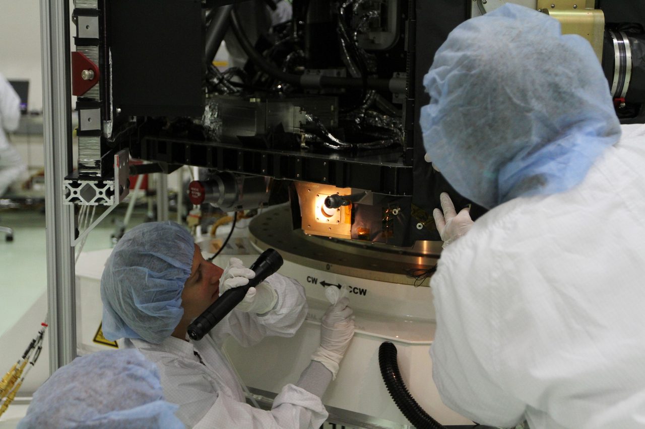
Hubble observations must account for the anomaly: particle strikes can appear as false events or bright streaks in sensitive detectors. An affected image does not necessarily mean a spacecraft malfunction; the flight computer may continue operating normally.
Orbital Radar tracking data lists 16,614 active satellites on 4 November 2026. Orbital Radar's live catalogue contains 32,009 objects, including debris, on 4 November 2026. These totals are not counts of exposed spacecraft: orbital details in the Orbital Radar Satellite Library help distinguish their paths.
What does crossing the anomaly mean for ISS astronauts?

The International Space Station crosses the South Atlantic Anomaly, where trapped protons add to astronauts’ radiation exposure. Each crossing is a managed occupational exposure, not an automatic emergency: the station passes through a region where Earth’s inner radiation belt comes closest to the surface.
Orbital Radar tracking data records 10 people in space as of 4 November 2026. That is a total across spaceflight missions, not an ISS crew count, and it does not indicate any individual’s radiation dose. Exposure depends on where a person is, the shielding around them and how long they spend in orbit.
Astronauts use dosimeters (instruments that measure accumulated radiation exposure) to track their dose. Measurements help teams assess exposure over a mission rather than treating every anomaly crossing as an isolated crisis. Conditions also vary within the station: its structure, equipment and supplies provide different amounts of shielding in different locations.
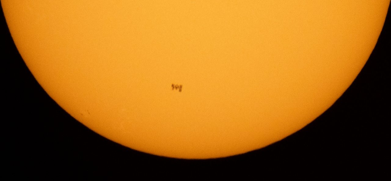
The station’s exterior helps put that protection in context: astronauts live inside enclosed modules, not behind an impenetrable radiation barrier. Spacecraft materials stop some particles and reduce the energy of others, but sufficiently energetic particles can penetrate them; interactions with shielding can also produce secondary radiation. Shielding therefore reduces exposure without eliminating it.
This recurring encounter with trapped radiation differs from a sudden solar particle event, when an eruption on the Sun sends energetic particles into space. The anomaly is a known feature of the ISS orbital environment. Orbital Radar’s satellite library provides spacecraft context for understanding why a satellite’s route matters to its radiation exposure.
How do spacecraft operators prevent radiation failures?
Spacecraft operators reduce radiation failures through resilient electronics, shielding, error recovery and carefully timed instrument shutdowns. No single measure prevents every type of particle damage. According to Orbital Radar tracking data, 16,614 satellites were active in orbit on 4 November 2026.
Engineers select radiation-tolerant components and test hardware against the exposure expected during its mission. Shielding can reduce some exposure, but adding material increases spacecraft mass and cannot stop every energetic particle. Protection must therefore match the orbit, mission lifetime and the consequences of losing particular equipment.
Error-correcting memory detects and repairs certain corrupted bits (the smallest units of digital information). Memory scrubbing periodically checks stored data and repairs correctable errors before they accumulate. Redundant computers provide backup processing, while watchdog timers detect stalled software and trigger a reset or switch to another computer.
During predicted South Atlantic Anomaly passages, operators may suspend sensitive observations, reduce detector activity or power down selected equipment. These measures limit unwanted detector signals and exposure of vulnerable systems. Routine instrument protection is not necessarily spacecraft safe mode: safe mode is a broader, reduced-activity state designed to preserve essential functions, including power and communications.
Recovery procedures help controllers restore operations, while recorded radiation events inform later operating decisions and investigations. Orbital Radar's live catalogue contained 32,009 objects, including debris, on 4 November 2026. Its satellite library provides context on individual spacecraft; their protection requirements differ, and neither resets nor shielding can reverse every form of permanent radiation damage.
Is the South Atlantic Anomaly the same as a solar storm?
No. The South Atlantic Anomaly is a persistent geographical feature of Earth’s magnetic field, not a solar storm. Over South America and the South Atlantic, the inner radiation belt (a region of magnetically trapped particles) extends closest to Earth, exposing low-orbiting satellites to elevated proton radiation even during quiet solar conditions.
A geomagnetic storm is a temporary disturbance of Earth’s magnetic environment driven by solar activity. Storms can redistribute trapped particles and change radiation-belt structure; their effects depend on orbit, particle energy and timing. Solar energetic particles, accelerated during solar eruptions, are a separate radiation source rather than the cause of the anomaly.
Orbital Radar tracking data lists 16,614 active satellites as of 4 November 2026. That population spans different orbits: it is not a count of spacecraft crossing the anomaly.
Radiation errors and atmospheric drag are also different hazards. Energetic particles can upset electronic memory, whereas solar activity can heat and expand the upper atmosphere, increasing resistance to spacecraft motion and accelerating orbital decay. Orbital Radar’s live catalogue contains 32,009 objects, including debris, as of 4 November 2026; their exposure to either hazard varies with orbit.
Orbital Radar’s space-weather page provides solar and geomagnetic context. A quiet interval does not remove the anomaly: satellites crossing it still encounter the underlying region of elevated radiation.
How can you check an ISS crossing on Orbital Radar?
Open Orbital Radar’s ISS tracker, identify the International Space Station by NORAD catalogue number 25544, and locate its current position and ground track (the path directly beneath its orbit). Follow that track across the map to see whether the station’s route passes over South America and the South Atlantic.
A passage through this broad geographical area helps you recognise a potential South Atlantic Anomaly crossing, but it is not a precise radiation forecast. The anomaly is the region where the inner radiation belt comes closest to Earth, exposing low-orbiting spacecraft to elevated proton radiation. Comparing the station’s route with those continents and waters provides geographical context, not a measurement of the radiation encountered.
Keep Orbital Radar’s South Atlantic Anomaly explanation alongside the tracker to connect the orbital view with that physical picture. A ground track alone cannot establish particle flux (the rate at which particles pass through a given area), their energy distribution, or absorbed dose (the radiation energy deposited per unit mass). Nor can it tell you whether an instrument has entered a protective state; that requires information about the instrument’s actual operating status.
Optical visibility from the ground is a separate question from radiation exposure. An ISS passage over the anomaly does not establish whether an observer can see the station: visibility also depends on sunlight, viewing geometry and local conditions.
Is the anomaly changing, and what would that mean for satellites?
Yes. The South Atlantic Anomaly changes position and shape as Earth's magnetic field evolves, so satellite exposure cannot be represented by a permanently fixed boundary. This gradual evolution is called secular variation: flows of electrically conducting liquid iron in Earth's outer core alter the field generated within the planet.
Over South America and the South Atlantic, the inner radiation belt reaches closest to Earth, exposing low-orbiting spacecraft to elevated proton radiation. As the underlying magnetic field changes, the geography of that exposure changes too. A moving or reshaping contour is not, by itself, evidence of an imminent magnetic reversal, in which Earth's magnetic polarity switches.
That long-term evolution is distinct from shorter-term changes in the radiation environment. Solar activity and disturbances in Earth's magnetic environment can alter particle populations much faster than secular variation changes the background field. A radiation map also depends on altitude, particle energy and the threshold chosen to draw its boundary; it is not a universal dividing line between safe and unsafe flight.
Orbital Radar's live catalogue contains 32,009 objects, including satellites and debris, as of 4 November 2026. That total describes the scale of orbital activity, not the number of spacecraft suffering radiation faults; Orbital Radar's satellite library provides spacecraft context. Operators therefore need updated environmental models and protection tailored to each mission's orbit, electronics and instruments—not a single permanent danger zone drawn on a map.
Key takeaways
- The South Atlantic Anomaly brings the inner radiation belt unusually close to Earth over South America and the South Atlantic, increasing exposure for spacecraft passing through it.
- Energetic particles can cause recoverable electronic errors, damage components and contaminate scientific measurements, with outcomes depending on the spacecraft and its exposure.
- ISS astronauts receive additional radiation during anomaly crossings, making shielding, dose monitoring and exposure management important.
- Orbital Radar's ISS tracker shows the station's orbital position, but a ground track alone cannot reveal radiation intensity or crew dose.
Frequently Asked Questions
Can the South Atlantic Anomaly affect people on the ground?
Can an ordinary aircraft encounter South Atlantic Anomaly radiation?
Does the South Atlantic Anomaly cause the Bermuda Triangle?
Can a satellite manoeuvre around the South Atlantic Anomaly?
Does the South Atlantic Anomaly disrupt GPS or mobile phones?
Cite this article
Pick a style, then copy it or download it for your reference manager.Orbital Radar. (2026, November 4). South Atlantic Anomaly: Why Satellites Glitch. Retrieved November 4, 2026, from https://orbitalradar.com/blog/radiation-belts-and-south-atlantic-anomaly
“South Atlantic Anomaly: Why Satellites Glitch.” Orbital Radar, 4 Nov. 2026, orbitalradar.com/blog/radiation-belts-and-south-atlantic-anomaly. Accessed 4 Nov. 2026.
Orbital Radar (2026) South Atlantic Anomaly: Why Satellites Glitch. Available at: https://orbitalradar.com/blog/radiation-belts-and-south-atlantic-anomaly (Accessed: 4 November 2026).
Orbital Radar. “South Atlantic Anomaly: Why Satellites Glitch.” Last modified November 4, 2026. https://orbitalradar.com/blog/radiation-belts-and-south-atlantic-anomaly.
@misc{orbitalradar_blog_radiation_belts_and_south_atlantic_anomaly,
  author       = {{Orbital Radar}},
  title        = {South Atlantic Anomaly: Why Satellites Glitch},
  year         = {2026},
  month        = nov,
  howpublished = {\url{https://orbitalradar.com/blog/radiation-belts-and-south-atlantic-anomaly}},
  url          = {https://orbitalradar.com/blog/radiation-belts-and-south-atlantic-anomaly},
  urldate      = {2026-11-04},
  note         = {Accessed 2026-11-04}
}
TY - ELEC AU - Orbital Radar, TI - South Atlantic Anomaly: Why Satellites Glitch PY - 2026 DA - 2026/11/04 PB - Orbital Radar UR - https://orbitalradar.com/blog/radiation-belts-and-south-atlantic-anomaly Y2 - 2026/11/04 LA - en ER -
Live figures change, so keep the date you accessed the page. How to cite Orbital Radar