Cislunar Space Situational Awareness: Beyond GEO
Tracking spacecraft near the Moon takes more than extending an Earth-orbit catalogue. Faint targets, shifting trajectories and patchy coverage demand a different approach.
| Active satellites | 16,696 |
| Starlink active | 9,814 |
| Catalogued objects | 32,132 |
| Active close approaches | 17 |
| People in space | 10 |
Cislunar space situational awareness means detecting, tracking and understanding spacecraft and other objects in the Earth–Moon region. Beyond geostationary orbit (GEO), faint targets, interrupted observations and the combined gravitational influence of Earth and the Moon make that task harder.
GEO lies 35,786 km above the equator, where satellites match Earth's rotation and appear to hover over one location. Tracking farther afield requires more than extending a familiar orbital map.
Orbital Radar's live catalogue lists 16,696 active satellites as of 16 November 2026. That overall count provides context for space surveillance, not a census of cislunar spacecraft. Knowing where an object is predicted to be is also different from independently observing it: a displayed position need not represent a fresh detection.
This article moves from geography and tracking physics to lunar missions, sensor programmes and the limits of public tracking displays. Orbital Radar's space situational awareness toolkit provides a starting point for exploring how observations and predictions contribute to an understanding of orbital activity.
Where does cislunar space begin, and how far does it extend?
Cislunar space is the Earth–Moon region, not a single orbital shell with universally agreed boundaries. Operational definitions differ: some focus on routes between Earth and the Moon, while others include lunar orbits and nearby regions shaped by their combined gravitational influence.
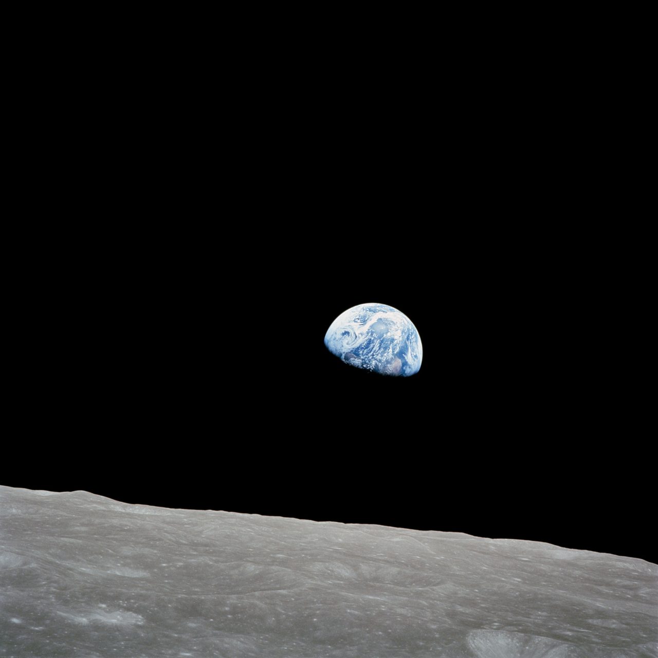
Geostationary orbit (GEO) is circular, 35,786 km above the equator; satellites there match Earth's rotation and appear fixed in the sky. The Moon averages about 384,400 km from Earth's centre. These measurements use different starting points: altitude above Earth's surface versus centre-to-centre distance.
Orbital Radar's live catalogue lists 16,696 active satellites as of 16 November 2026. That population should not be mistaken for a count of cislunar spacecraft.
Geosynchronous orbits match Earth's rotation period but need not be circular or equatorial, so their satellites can move across the sky. Translunar trajectories carry spacecraft towards the Moon; lunar orbits circle it. Not everything beyond GEO is Moon-bound.
Orbital Radar tracking data lists 32,132 catalogued objects, including debris, as of 16 November 2026. Catalogue size alone does not describe coverage across the Earth–Moon region.
Lagrange points are locations where gravity and orbital motion create useful geometry in a rotating reference frame—not places where gravity disappears. Orbital Radar's Moon Globe provides context for the Moon's changing position within this region.
Why are spacecraft beyond GEO so difficult to detect?
Spacecraft beyond geostationary orbit (GEO) are difficult to detect because they are distant, often faint and not continuously visible. For otherwise unchanged viewing conditions, doubling the distance from an optical telescope reduces the reflected light it receives to a quarter. Apparent brightness also depends on the spacecraft’s size, surface reflectivity, orientation and how much of its sunlit side faces the observer.
Pointing at the correct region does not guarantee a detection. Sunlight scattered through the atmosphere can overwhelm a faint target, while glare from the bright Moon can hide nearby spacecraft. Earth’s shadow can remove their direct solar illumination; occultations, when Earth or the Moon blocks the line of sight, prevent observations altogether.
Optical telescopes collect reflected sunlight, so they need suitable illumination and sufficient contrast against the sky. Radar supplies its own illumination, but its signal spreads on the outward journey and the returning echo spreads again. For an otherwise unchanged target and radar configuration, doubling the range leaves only a sixteenth of the received echo power.
Ground-based optical coverage also has gaps caused by clouds, daylight and competing demands for telescope time. Even a detected moving point is not automatically an identified spacecraft with a known orbit: a short sighting provides limited information about distance and motion. That distinction underpins Orbital Radar’s space situational awareness hub: awareness means knowing what an object is doing, not merely seeing it.
Why do lunar trajectories need different tracking methods?
Lunar trajectories need different tracking methods because an Earth-centred model dominated by Earth's gravity often becomes inadequate near the Moon. Lunar gravity and solar perturbations (changes caused by the Sun's gravitational pull) can materially alter a spacecraft's path. Cislunar space situational awareness therefore needs trajectory models that account for these competing influences.
A near-rectilinear halo orbit is an elongated trajectory around an Earth–Moon Lagrange-point region, where gravitational effects and orbital motion allow particular orbital configurations. Unlike a conventional low lunar orbit, which circles close to the Moon, this trajectory sweeps between a close lunar passage and a much more distant arc. Predicting its motion requires more than treating the Moon as an isolated attracting body.
Tracking also means extracting motion from incomplete measurements. With angles-only observations, a telescope measures an object's direction against the sky, not its distance or full velocity. Repeated observations, or additional measurements such as range, help constrain the possible trajectories.
An uncertain manoeuvre introduces uncertainty about how the spacecraft's velocity changed. During a long observation gap, plausible trajectories can diverge, expanding the region that observers must search to reacquire the object. The predicted direction alone may no longer provide a sufficiently narrow search area.
An orbit estimate is the best-fitting trajectory; its uncertainty describes the range of positions and velocities consistent with the measurements and modelling assumptions. A precise-looking map marker does not establish equally precise knowledge. When using Orbital Radar's space situational awareness toolkit, that distinction matters: displaying a position and measuring it accurately are different things.
Which spacecraft and objects occupy the Earth–Moon region?
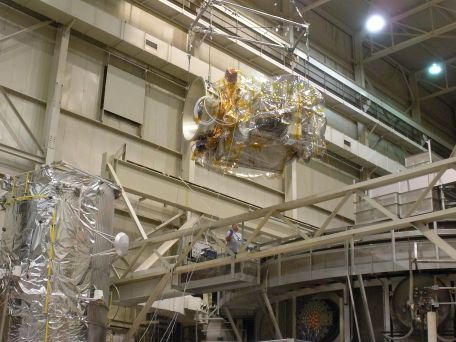
The Earth–Moon region contains science orbiters, communications relays, navigation demonstrators, transfer stages and spacecraft in transit, alongside spent hardware and passing natural objects. A cislunar inventory is therefore broader than a list of active lunar satellites.
NASA’s Lunar Reconnaissance Orbiter illustrates a low polar lunar orbit, suited to repeated surface mapping. CAPSTONE was sent to demonstrate a near-rectilinear halo orbit: an elongated path shaped by Earth–Moon gravity, of the type planned for Gateway. China’s Queqiao relay missions illustrate other architectures: the original used a halo orbit around the Earth–Moon L2 gravitational balance region beyond the Moon, while Queqiao-2 was sent into an elliptical lunar orbit to support communications.
Those mission descriptions do not establish present operating status. “Active” means functioning; “remaining in orbit” means physically present, even if silent; “publicly available trajectory” means published position predictions exist, not necessarily that independent observers have recently confirmed them.
Orbital Radar tracking data lists 32,132 catalogued objects as of 16 November 2026, but that headline total is not a cislunar census. Orbital Radar tracking data includes 2,218 rocket bodies, underscoring why payloads alone cannot describe the tracked population.
Spent stages and released hardware may remain on Earth-centred or solar orbits, return through the region or strike the Moon. Confirmed lunar impacts belong in the historical record, not the current orbiting inventory; passing asteroids and meteoroids also matter. Orbital Radar’s deep-space mission pages provide wider mission context, not independent surveillance or proof of a spacecraft’s current location.
Who is building sensors to watch cislunar space?
The US Air Force Research Laboratory (AFRL), ground-based observatories, university research teams and commercial optical operators are developing capabilities relevant to cislunar space situational awareness: knowing what occupies the Earth–Moon region and what it is doing. AFRL’s Oracle programme is associated with demonstrating space-based detection and tracking in that region; its announced objectives should not be mistaken for demonstrated, continuous operational coverage.
Ground-based optical observatories contribute telescope observations, while research teams develop wide-area searches, methods for detecting faint objects and techniques for estimating trajectories from limited sightings. Searching a broad sky area and collecting enough light to detect a dim spacecraft compete for telescope time, so survey design matters alongside telescope size.
NASA’s Deep Space Network and ESA’s Estrack serve a different primary purpose: communicating with known missions and supporting their navigation through radio measurements. They are not general-purpose search networks for previously unidentified objects or spacecraft that do not cooperate with tracking, although their measurements can help establish participating missions’ trajectories.
Commercial optical networks can contribute time-stamped positions and brightness measurements where their telescopes, observing schedules and processing methods permit. An established Earth-orbit tracking service does not, by itself, demonstrate comprehensive lunar coverage: sensitivity, accessible viewing directions and the ability to recover an object on later nights all need evidence.
Earth-based telescopes are generally easier to maintain and expand, but face clouds, daylight and atmospheric interference. Space-based sensors avoid terrestrial weather and can offer complementary viewing geometry, but require launch, communications and spacecraft operations, with associated costs and constraints. Orbital Radar’s space agencies directory provides institutional context for organisations involved in these efforts.
How do separate observations become a reliable space picture?
Separate observations become a reliable space picture by linking detections, estimating a trajectory and testing it against subsequent measurements. Detection finds a candidate object; association determines whether observations belong to that same object rather than unrelated targets.
Each observation needs a precise time, the sensor’s location and an uncertainty estimate describing its measurement limits. Without these, another team cannot reliably reconstruct the viewing geometry or judge how much weight to give the result. Orbit determination fits a trajectory to the measurements; follow-up observations test the prediction and can expose a mistaken association or an unexpected manoeuvre.
Operator-supplied ephemerides—predicted positions over time—describe where a spacecraft is expected to be. Independent measurements test that expectation, while fused tracking products combine observations into an estimate with stated uncertainties. Shared inputs mean apparently separate products are not necessarily independent.
For cooperative spacecraft, radio ranging measures distance through signal travel time, while Doppler measurements use frequency shifts to constrain motion towards or away from a receiver. Unidentified objects may provide no usable radio signal.
Orbital Radar’s live catalogue contains 32,132 objects as of 16 November 2026. Orbital Radar tracking data lists 16,696 active satellites as of 16 November 2026. These broad orbital totals do not establish cislunar coverage: commercial restrictions and national-security concerns can limit disclosure. As the Orbital Radar space situational awareness hub helps explain, a public catalogue is an information product, not the full observing network; absent public data does not establish that an object is untracked.
Does cislunar surveillance mean tracking debris or military activity?
Cislunar surveillance can support both debris tracking and defence monitoring, but these are distinct purposes, not interchangeable descriptions of the same activity. Space situational awareness (SSA) means knowing what is in orbit and what it is doing, including detecting objects, predicting close approaches and spotting manoeuvres or break-ups.
Orbital Radar tracking data lists 32,132 catalogued objects, including payloads, rocket bodies and debris, as of 16 November 2026. This catalogue total is not a count of objects near the Moon and cannot establish how crowded cislunar space is.
Collision avoidance asks whether predicted paths could bring objects dangerously close. Mission navigation asks where a spacecraft is and which manoeuvres will take it to its destination. Defence monitoring asks what observed activity could mean for security; all can use overlapping observations while answering different questions.
An unexpected manoeuvre does not establish intent: a course correction or fault response may also explain a changed trajectory. Trajectory uncertainty—the range of possible paths consistent with the measurements—can complicate assessments of proximity, so apparent closeness alone is not evidence of a deliberate approach.
Responsible surveillance therefore belongs alongside disposal planning and transparent operations, including sharing planned manoeuvres where practicable. Orbital Radar’s explanation of space debris clarifies why inactive hardware still matters: losing its function does not remove its physical presence or potential collision hazard.
How can you explore cislunar tracking on Orbital Radar?
Start with Orbital Radar’s space situational awareness hub, then use its lunar globe to explore Earth–Moon geometry. Space situational awareness means knowing what is in orbit and what it is doing, including detecting objects, cataloguing them and predicting their motion.
Keep those activities distinct: detection is a sensor recording an object; catalogue information describes an identified object; predicted motion estimates where it will travel. A catalogue entry or plotted trajectory is not, by itself, evidence of a fresh observation.
Open the Moon globe to explore the Moon’s current position, phase and displayed orbiters. Treat the globe as a way to understand geometry, rather than proof that Orbital Radar has independently detected each spacecraft shown.
For any displayed mission, identify the spacecraft and the reference frame (the coordinate system used to describe its position). Read the stated update information and establish whether positions represent observations or predictions; an animated marker can follow a calculated trajectory between observations.
Use /deep-space for mission context and /glossary/ssa for terminology, keeping your exploration focused on the Earth–Moon region rather than the wider Solar System. Public displays have limits: a missing marker does not prove that a region is empty, and a moving marker does not establish continuous sensor coverage.
What would dependable cislunar monitoring require?
Dependable cislunar space situational awareness requires complementary viewing locations, repeated observations and organisations able to sustain the work. No single telescope can provide continuous coverage: observations from different locations must compensate for one another’s blind spots and return to objects often enough to keep their predicted paths useful.
Shared reference frames (the coordinate systems used to describe positions and motion) are essential. Interoperable observation formats must carry observation times and uncertainty information, so different organisations can interpret measurements consistently rather than exchange positions that merely appear precise.
Performance should be judged by practical questions: how faint an object can be detected, how much sky can be searched, how frequently each object is revisited and how quickly a lost track can be recovered. Those measures need stated observing conditions; detecting a favourable target does not establish dependable coverage across the Earth–Moon region.
A sensor demonstration proves a capability under particular circumstances, not a sustained service. That requires dependable staffing, communications, maintenance and follow-up capacity when an observation is ambiguous or a spacecraft manoeuvres.
As the Orbital Radar space situational awareness hub explains, awareness extends beyond detection to cataloguing objects and understanding their behaviour. Useful cislunar monitoring must therefore show not just spacecraft positions, but how well they are known, where coverage is weak and when fresh evidence is needed.
Key takeaways
- Cislunar space situational awareness combines detecting objects, estimating their trajectories and understanding activity across the Earth–Moon region.
- Distance, illumination, interrupted visibility and complex gravitational dynamics make lunar tracking different from extending an Earth-orbit catalogue.
- Communications networks, surveillance sensors and operator-provided trajectories contribute different kinds of evidence and should not be treated as interchangeable.
- Orbital Radar's Moon globe and space situational awareness hub help readers explore the region without implying that public displays provide complete surveillance.
Frequently Asked Questions
Can amateur astronomers photograph spacecraft near the Moon?
Can GPS be used to navigate spacecraft near the Moon?
What is the difference between space situational awareness and space domain awareness?
Can a spacecraft remain permanently hidden behind the Moon?
How does space weather affect communications with lunar spacecraft?
Cite this article
Pick a style, then copy it or download it for your reference manager.Orbital Radar. (2026, November 16). Cislunar Space Situational Awareness: Beyond GEO. Retrieved November 16, 2026, from https://orbitalradar.com/blog/cislunar-space-situational-awareness
“Cislunar Space Situational Awareness: Beyond GEO.” Orbital Radar, 16 Nov. 2026, orbitalradar.com/blog/cislunar-space-situational-awareness. Accessed 16 Nov. 2026.
Orbital Radar (2026) Cislunar Space Situational Awareness: Beyond GEO. Available at: https://orbitalradar.com/blog/cislunar-space-situational-awareness (Accessed: 16 November 2026).
Orbital Radar. “Cislunar Space Situational Awareness: Beyond GEO.” Last modified November 16, 2026. https://orbitalradar.com/blog/cislunar-space-situational-awareness.
@misc{orbitalradar_blog_cislunar_space_situational_awareness,
  author       = {{Orbital Radar}},
  title        = {Cislunar Space Situational Awareness: Beyond GEO},
  year         = {2026},
  month        = nov,
  howpublished = {\url{https://orbitalradar.com/blog/cislunar-space-situational-awareness}},
  url          = {https://orbitalradar.com/blog/cislunar-space-situational-awareness},
  urldate      = {2026-11-16},
  note         = {Accessed 2026-11-16}
}
TY - ELEC AU - Orbital Radar, TI - Cislunar Space Situational Awareness: Beyond GEO PY - 2026 DA - 2026/11/16 PB - Orbital Radar UR - https://orbitalradar.com/blog/cislunar-space-situational-awareness Y2 - 2026/11/16 LA - en ER -
Live figures change, so keep the date you accessed the page. How to cite Orbital Radar