Envisat: The Giant Dormant Satellite and Its Collision Risk
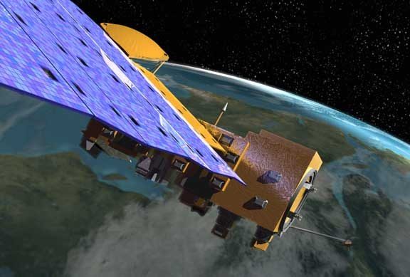
Envisat, launched by the European Space Agency (ESA) on 1 March 2002, was one of the largest Earth observation satellites ever constructed. With a mass of approximately 8,211 kilograms and dimensions akin to a double-decker bus, Envisat carried ten sophisticated instruments designed to monitor the E
What is Envisat?
Envisat, launched by the European Space Agency (ESA) on 1 March 2002, was one of the largest Earth observation satellites ever constructed. With a mass of approximately 8,211 kilograms and dimensions akin to a double-decker bus, Envisat carried ten sophisticated instruments designed to monitor the Earth's atmosphere, land, sea, and ice. The satellite's mission was to provide crucial data for environmental monitoring and climate change research.
Mission and Purpose
Envisat's primary mission was to continue and expand the data collection efforts of earlier ESA missions such as ERS-1 and ERS-2. Its suite of instruments included the Advanced Synthetic Aperture Radar (ASAR), the Medium Resolution Imaging Spectrometer (MERIS), and the Global Ozone Monitoring by Occultation of Stars (GOMOS), among others. These tools allowed Envisat to gather comprehensive data on sea surface temperatures, ocean colour, atmospheric gases, and ice sheet dynamics, contributing significantly to our understanding of environmental processes and climate change.
Orbital Characteristics
Envisat operated in a Sun-synchronous polar orbit, which allowed it to pass over the same part of the Earth at roughly the same local solar time. This orbit had an altitude of approximately 790 kilometres and an inclination of 98.55 degrees. With a NORAD ID of 27386, Envisat completed an orbit every 101 minutes, enabling it to provide near-global coverage every three days. This orbit was optimal for consistent lighting conditions, essential for accurate Earth observation.
Significance and Legacy
During its operational life, Envisat delivered a wealth of data that was instrumental in numerous scientific studies and environmental monitoring programmes. Its observations have been used in over 4,000 scientific publications, influencing policy decisions and contributing to international environmental agreements. Even after its mission ended, Envisat's legacy continues through the data it provided, which remains a valuable resource for researchers worldwide.
Current Status and Collision Risk
Envisat ceased communication with Earth in April 2012, leaving it as a large piece of space debris in low Earth orbit. Its considerable size and altitude make it a significant collision risk, particularly in the increasingly crowded orbital environment. With over 29,215 catalogued objects in orbit, including 8,802 pieces of debris, the potential for collision is a growing concern. Envisat's status can be monitored via the Orbital Radar Satellite Library, which provides updates on active close approaches and potential collision scenarios.
📎 Cite this article
Orbital Radar Newsroom. (2026). Envisat: The Giant Dormant Satellite and Its Collision Risk. Orbital Radar. https://orbitalradar.com/blog/envisat-giant-dormant-satellite-collision-risk"Envisat: The Giant Dormant Satellite and Its Collision Risk." Orbital Radar, 16 August 2026, https://orbitalradar.com/blog/envisat-giant-dormant-satellite-collision-risk.@misc{orbitalradar_envisat_giant_dormant_satellite_collisio,
title = {Envisat: The Giant Dormant Satellite and Its Collision Risk},
author = {{Orbital Radar}},
year = {2026},
howpublished = {\url{https://orbitalradar.com/blog/envisat-giant-dormant-satellite-collision-risk}}
}